Montmorency (provincial electoral district)
CanElecResTopTest with bare yearProvincial electoral districts of Quebec CityQuebec provincial electoral districts
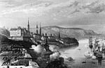
Montmorency is a provincial electoral district in the Capitale-Nationale region of Quebec, Canada. It comprises part of the Beauport borough of Quebec City and the municipality of Sainte-Brigitte-de-Laval. It was created for the 1867 election (and an electoral district of that name existed earlier in the Legislative Assembly of the Province of Canada and the Legislative Assembly of Lower Canada). In the change from the 2001 to the 2011 electoral map, it lost much of its territory to the new electoral district of Charlevoix–Côte-de-Beaupré. It was named after François de Laval the first Roman Catholic bishop in New France.
Excerpt from the Wikipedia article Montmorency (provincial electoral district) (License: CC BY-SA 3.0, Authors).Montmorency (provincial electoral district)
Chemin du Grand-Duc,
Geographical coordinates (GPS) Address Nearby Places Show on map
 Continue reading on Wikipedia
 Geographical coordinates (GPS)
| Latitude | Longitude |
|---|---|
| N 46.966666666667 ° | E -71.283333333333 ° |
Address
Chemin du Grand-Duc
G3B 1B3
Quebec, Canada
Open on Google Maps