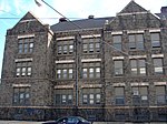
Castor Gardens, Philadelphia

Castor Gardens is a neighborhood in the lower Northeast section of Philadelphia, Pennsylvania, United States. Castor Gardens' borders are ill-defined, but it exists in the vicinity of Castor Avenue and Cottman Avenue. It is also near Roosevelt Boulevard. The neighborhood can either be entered from the south, by taking the Oxford Circle exit of Roosevelt Boulevard, or from the north, by taking the Cottman Avenue exit. Adjacent neighborhoods are Mayfair, Lawndale, Burholme, Oxford Circle, and Rhawnhurst. Castor Gardens uses the zip codes 19111 and 19149. The area is served by Roosevelt Mall, one of the largest shopping centers in Philadelphia, the Northeast Regional Library branch of the Free Library of Philadelphia, and the District 10 Health Center of the city of Philadelphia.
Excerpt from the Wikipedia article Castor Gardens, Philadelphia (License: CC BY-SA 3.0, Authors, Images).Castor Gardens, Philadelphia
Castor Avenue, Philadelphia
Geographical coordinates (GPS) Address Nearby Places Show on map
Geographical coordinates (GPS)
| Latitude | Longitude |
|---|---|
| N 39.993 ° | E -75.092 ° |
Address
The Home Depot
Castor Avenue
19314 Philadelphia
Pennsylvania, United States
Open on Google Maps


