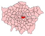
Bermondsey (parish)
Bermondsey (also known as St. Mary Magdalen, Bermondsey) was a parish in the metropolitan area of London, England. The ancient parish was part of Hundred of Brixton and County of Surrey. In 1855, it was included in the area of responsibility of the Metropolitan Board of Works (MBW). The act, establishing the MBW, also incorporated a new elected local authority for the parish known as The Vestry of the Parish of Bermondsey in the County of Surrey.The population of the parish in 1896 was 84,632, and it had adopted the Public Libraries Act 1850 in 1887. For electoral purposes, the parish was divided into four wards and had 120 elected vestrymen. In 1889, the area of the Metropolitan Board was reconstituted as the County of London, and Bermondsey was transferred to the new county. In 1900, the County of London was divided into twenty-eight metropolitan boroughs. The parish became the core part of the Metropolitan Borough of Bermondsey, which also covered the parish of Rotherhithe, and the area of the St Olave's District Board of Works (consisting of the two parishes of Southwark St John Horsleydown and Southwark St Olave and St Thomas). A borough council replaced the vestries and board, and in 1904, all four parishes in the borough were merged as the single civil parish of Bermondsey.
Excerpt from the Wikipedia article Bermondsey (parish) (License: CC BY-SA 3.0, Authors).Bermondsey (parish)
St James's Road, London Bermondsey (London Borough of Southwark)
Geographical coordinates (GPS) Address Nearby Places Show on map
Geographical coordinates (GPS)
| Latitude | Longitude |
|---|---|
| N 51.492 ° | E -0.065 ° |
Address
St James's Road / Southwark Park Road
St James's Road
SE1 5BP London, Bermondsey (London Borough of Southwark)
England, United Kingdom
Open on Google Maps


