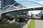
Limehouse

Limehouse is a district in the London Borough of Tower Hamlets in East London. It is 3.9 miles (6.3 km) east of Charing Cross, on the northern bank of the River Thames. Its proximity to the river has given it a strong maritime character, which it retains through its riverside public houses and steps, such as The Grapes and Limehouse Stairs. It is part of the traditional county of Middlesex. It became part of the ceremonial County of London following the passing of the Local Government Act 1888, and then part of Greater London in 1965. It is located between Stepney to the west and north, Mile End and Bow to the northwest, Poplar to the east, and Canary Wharf and Millwall to the south, and stretches from the end of Cable Street and Butcher Row in the west to Stainsby Road near Bartlett Park in the east, and from West India Dock (South Dock) and the River Thames in the south to Salmon Lane and Rhodeswell Road in the north. The area gives its name to Limehouse Reach, a section of the Thames which runs south to Millwall after making a right-angled bend at Cuckold's Point, Rotherhithe. The west-to-east section upstream of Cuckold's Point is properly called the Lower Pool.
Excerpt from the Wikipedia article Limehouse (License: CC BY-SA 3.0, Authors, Images).Limehouse
Dora Street, London Limehouse
Geographical coordinates (GPS) Address Nearby Places Show on map
Geographical coordinates (GPS)
| Latitude | Longitude |
|---|---|
| N 51.5158 ° | E -0.0318 ° |
Address
Dora Street 13-24
E14 7TP London, Limehouse
England, United Kingdom
Open on Google Maps


