place

Fort Point, Boston

Accuracy disputes from March 2022Fort Point, BostonNeighborhoods in Boston
Boston, 1775bsmall1
Boston, 1775bsmall1

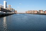
Fort Point is a neighborhood or district of Boston, Massachusetts, and where a fort stood which guarded the city in colonial times.

Excerpt from the Wikipedia article Fort Point, Boston (License: CC BY-SA 3.0, Authors, Images).

Fort Point, Boston
A Street, Boston South Boston

Geographical coordinates (GPS) Address Nearby Places
placeShow on map

Wikipedia: Fort Point, BostonContinue reading on Wikipedia

Geographical coordinates (GPS)

Latitude Longitude
N 42.348506 ° E -71.050364 °
placeShow on map

Address

300 A Street

A Street 300
02210 Boston, South Boston
Massachusetts, United States
mapOpen on Google Maps

Boston, 1775bsmall1
Boston, 1775bsmall1
Share experience

Nearby Places

Fort Point Channel
Fort Point Channel

Fort Point Channel is a maritime channel separating South Boston from downtown Boston, Massachusetts, feeding into Boston Harbor. The south part of it has been gradually filled in for use by the South Bay rail yard and several highways (specifically the Central Artery and the Southeast Expressway). At its south end, the channel once widened into South Bay, from which the Roxbury Canal continued southwest where the Massachusetts Avenue Connector is now. The Boston Tea Party occurred at its northern end. The channel is surrounded by the Fort Point neighborhood, which is also named after the same colonial-era fort. The banks of the channel are still busy with activity. South of Summer Street on the west side of the channel is a large United States Postal Service facility. A large parcel, home to Gillette, lies at the southeast corner of the channel. The back of the Federal Reserve Bank of Boston building looks over the channel, and another federal building, the John Joseph Moakley United States Courthouse, lies on Fan Pier at the mouth of the channel. One of Boston's odder attractions, the Hood Milk Bottle, lies on the banks as well, next to Boston Children's Museum. During the 1980s, a nightclub and popular concert venue called The Channel was located on the South Boston bank. On October 21, 2011, Fort Point Pier opened for public use south of the Summer Street Bridge. To prepare for construction, a fifty-foot (15 m) section of the Fort Point Channel seawall south of Necco Court was restored by P&G Gillette. Public access has made Fort Point Channel popular for kayaking and standup paddle boarding.

Congress Street Grounds

Congress Street Grounds is a former baseball ground located in Boston, Massachusetts. The ballpark, as the name implies, was along Congress Street, near the intersection of Thompson Place, and not far from the Fort Point Channel on South Boston Flats, a newly filled in piece of land on Boston Harbor. The ground was home to the Boston Reds, that played in the Players' League in 1890 and the American Association in 1891.Although a short-lived facility, the ballpark witnessed some significant history. First, its occupants won league pennants in their two years of existence. Despite its success, the club was dropped during the NL-AA merger of 1892, as there was already an NL entry in Boston. Then, between May and June 1894, Congress Street Grounds was the home to the Boston Beaneaters while their home grounds, the South End Grounds, were being rebuilt after the Great Roxbury Fire of May 15, 1894. It had a close left field fence, which benefited Boston's Bobby Lowe just a couple of weeks later, on May 30, 1894, as he became the first batter to hit four home runs in a single game, all of them down the line in left field. The location is now occupied by several office buildings, and the alley behind them, which would go through the area of the outfield, was used in the 2006 film The Departed, in a key scene where Martin Sheen's character is pushed off a roof. Historic New England has a photo of the interior of the park. Historic New England