place

Fort Point Channel tunnel

American tunnel stubsTunnels in Boston

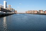
The Fort Point Channel Tunnel is a tunnel underneath the South Boston Streets and Fort Point Channel. It was built using a casting basin. It was built 1991–1994 in the Big Dig.In 2006 a ceiling tile and associated debris weighing 26 tons collapsed, causing the death of a passenger in a vehicle in the tunnel and severe injury to the driver. This incident and the resulting inspections and repairs delayed the Big Dig construction project by a year.

Excerpt from the Wikipedia article Fort Point Channel tunnel (License: CC BY-SA 3.0, Authors).

Fort Point Channel tunnel
Massachusetts Turnpike, Boston South Boston

Geographical coordinates (GPS) Address Nearby Places
placeShow on map

Wikipedia: Fort Point Channel tunnelContinue reading on Wikipedia

Geographical coordinates (GPS)

Latitude Longitude
N 42.347 ° E -71.054 °
placeShow on map

Address

Massachusetts Turnpike

Massachusetts Turnpike
02210 Boston, South Boston
Massachusetts, United States
mapOpen on Google Maps

Share experience

Nearby Places

Fort Point Channel
Fort Point Channel

Fort Point Channel is a maritime channel separating South Boston from downtown Boston, Massachusetts, feeding into Boston Harbor. The south part of it has been gradually filled in for use by the South Bay rail yard and several highways (specifically the Central Artery and the Southeast Expressway). At its south end, the channel once widened into South Bay, from which the Roxbury Canal continued southwest where the Massachusetts Avenue Connector is now. The Boston Tea Party occurred at its northern end. The channel is surrounded by the Fort Point neighborhood, which is also named after the same colonial-era fort. The banks of the channel are still busy with activity. South of Summer Street on the west side of the channel is a large United States Postal Service facility. A large parcel, home to Gillette, lies at the southeast corner of the channel. The back of the Federal Reserve Bank of Boston building looks over the channel, and another federal building, the John Joseph Moakley United States Courthouse, lies on Fan Pier at the mouth of the channel. One of Boston's odder attractions, the Hood Milk Bottle, lies on the banks as well, next to Boston Children's Museum. During the 1980s, a nightclub and popular concert venue called The Channel was located on the South Boston bank. On October 21, 2011, Fort Point Pier opened for public use south of the Summer Street Bridge. To prepare for construction, a fifty-foot (15 m) section of the Fort Point Channel seawall south of Necco Court was restored by P&G Gillette. Public access has made Fort Point Channel popular for kayaking and standup paddle boarding.

Dewey Square Tunnel

The Dewey Square Tunnel in Boston, Massachusetts, is part of Interstate 93 (concurrent with US 1 and Route 3), running under the heart of the city's financial district, including Dewey Square. Built in 1959, it was part of Boston's Central Artery freeway construction project of the 1950s. Known to locals as the South Station Tunnel (due to its proximity to South Station), the Dewey Square Tunnel is of cut-and-cover design, and originally was six lanes wide (three in each direction), with no breakdown lanes. Because of public outcry during construction of The Central Artery, elevated for most of its length and reviled because it cut off views of and access to Boston's historic waterfront, it was decided by then-Governor John A. Volpe that the final section of the artery was to be put underground from just south of Congress Street to Kneeland Street near Boston's Chinatown section. At the time of its construction, it was the widest vehicular tunnel in the world. At one time, a bus terminal serving Peter Pan, Bonanza, and other regional bus lines sat atop the tunnel near its northern portal. The bus station has since been relocated to the major intermodal transportation hub at South Station. The lack of breakdown lanes, the limited number of travel lanes, and the myriad access ramps to and from the Artery and the tunnel caused massive traffic jams and gridlock, forcing transportation officials to consider rebuilding the Artery and putting it totally underground. The Dewey Square Tunnel received new life as part of the massive Big Dig project of the late 1990s and early 2000s. The tunnel was rehabilitated and now serves as exclusive southbound lanes of Interstate 93, complete with a new ventilation system and gently banked corners consistent with appropriate superelevation. Its old northern portal at Congress Street was connected to the underground southbound lanes of the new artery in 2005. A long-closed northbound off-ramp to Chinatown was rebuilt and reopened as a southbound on-ramp from Surface Road. The refurbished tunnel, with 6 lanes at its widest point, was fully opened on March 5, 2005. The Dewey Square Tunnel is the only remaining section of the original Central Artery still in use. Since the completion of the Big Dig project, the name "Dewey Square (South Station) Tunnel" has fallen into general disuse; instead, it is considered to be part of the Thomas P. O'Neill Jr. Tunnel, a name used for the entire length of the north–south tunnel system.