Rectory Road railway station

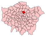
Rectory Road is a London Overground station on the Lea Valley lines in the West Hackney area of the London Borough of Hackney, east London. It is 3 miles 64 chains (6.1 km) down the line from London Liverpool Street and is between Hackney Downs and Stoke Newington stations. Its three-letter station code is REC and it is in Travelcard zone 2. Trains run south to Liverpool Street and north to either Cheshunt or Enfield Town. The ticket office, street buildings, staircases and platform shelters were all built in the mid-1980s in works funded by the Greater London Council (along with other stations in the "Tube-less" borough of Hackney). These elaborate structures were very different from the low-maintenance changes further up the line at the same time, and feature the British Rail logo worked into the brickwork at street-level. In 2015 the station and all services that call there were transferred from Abellio Greater Anglia operation to London Overground. The station was also added to the Tube map.
Excerpt from the Wikipedia article Rectory Road railway station (License: CC BY-SA 3.0, Authors, Images).Rectory Road railway station
Jenner Road, London West Hackney (London Borough of Hackney)
Geographical coordinates (GPS) Address Nearby Places Show on map
Geographical coordinates (GPS)
| Latitude | Longitude |
|---|---|
| N 51.559 ° | E -0.068 ° |
Address
Jenner Road
Jenner Road
N16 7RB London, West Hackney (London Borough of Hackney)
England, United Kingdom
Open on Google Maps


