Stoke Newington Common
Common land in LondonHackney, LondonParks and open spaces in the London Borough of HackneyStoke Newington

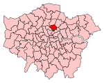
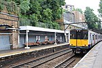
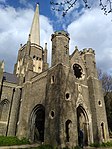
Stoke Newington Common is an open space in the London Borough of Hackney. It lies between Brooke Road to the south and Northwold Road to the north, straddling a railway line and the busy Rectory Road. The Common is 2.15 hectares (5.3 acres) in area.The Common was originally called Cockhanger Green but underwent a series of name changes. The Common is part of West Hackney, an area of Hackney that is often informally also described as part of Stoke Newington.
Excerpt from the Wikipedia article Stoke Newington Common (License: CC BY-SA 3.0, Authors, Images).Stoke Newington Common
Northwold Road, London West Hackney (London Borough of Hackney)
Geographical coordinates (GPS) Address Nearby Places Show on map
Geographical coordinates (GPS)
| Latitude | Longitude |
|---|---|
| N 51.562222222222 ° | E -0.07 ° |
Address
Stoke Newington
Northwold Road
N16 7DH London, West Hackney (London Borough of Hackney)
England, United Kingdom
Open on Google Maps


