West Hackney
Areas of LondonDistricts of the London Borough of Hackney

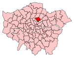
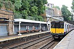
West Hackney is a district in the London Borough of Hackney, situated on the eastern side of Ermine Street, the major Roman Road better known as the A10. The area was part of the Ancient Parish and subsequent Metropolitan Borough of Hackney, but has come to be seen by many as an informal extension of Stoke Newington, as well as a sub-district of Hackney proper. Rectory Road, the principal railway station, lies 4.3 miles (6.9 km) northeast of Charing Cross.
Excerpt from the Wikipedia article West Hackney (License: CC BY-SA 3.0, Authors, Images).West Hackney
Rectory Road, London West Hackney (London Borough of Hackney)
Geographical coordinates (GPS) Address Nearby Places Show on map
Geographical coordinates (GPS)
| Latitude | Longitude |
|---|---|
| N 51.56 ° | E -0.07 ° |
Address
Rectory Road / Brooke Road
Rectory Road
N16 7SD London, West Hackney (London Borough of Hackney)
England, United Kingdom
Open on Google Maps


