A104 road (England)
Infobox road instances in EnglandInfobox road maps tracking categoryRoads in EnglandStreets in the London Borough of HackneyStreets in the London Borough of Islington ... and 4 more
Streets in the London Borough of Waltham ForestTransport in Epping Forest DistrictTransport in the London Borough of RedbridgeUse British English from February 2013

The A104 is an A road which runs from Islington Green in London to Epping in Essex, England.At its southern end, the A104 meets the A1 near Angel London Underground station in Islington. The route passes through Canonbury, Dalston, Hackney, Clapton, Leyton, Woodford and Buckhurst Hill before meeting the A121 at the Wake Arms roundabout. The northern terminus of the route is approximately 2.7 miles (4.3 km) south of St John's Church in Epping town centre, and approximately 1.3 miles (2.1 km) east of the M25 motorway at junction 26.
Excerpt from the Wikipedia article A104 road (England) (License: CC BY-SA 3.0, Authors, Images).A104 road (England)
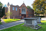
Woodford New Road, London Woodford Green (London Borough of Redbridge)
Geographical coordinates (GPS) Address Nearby Places Show on map
Geographical coordinates (GPS)
| Latitude | Longitude |
|---|---|
| N 51.60113 ° | E 0.01442 ° |
Address
Woodford New Road
Woodford New Road
IG8 9DX London, Woodford Green (London Borough of Redbridge)
England, United Kingdom
Open on Google Maps


