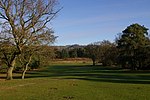
Buckland, Surrey
Civil parishes in SurreyMole ValleySurrey folkloreVillages in Surrey

Buckland is a village and civil parish in the Mole Valley district of Surrey, England, between Dorking and Reigate, its nearest towns. The civil parish is bordered by the North Downs escarpment in the north. The area contains a number of sand pits.
Excerpt from the Wikipedia article Buckland, Surrey (License: CC BY-SA 3.0, Authors, Images).Buckland, Surrey
Reigate Road, Mole Valley
Geographical coordinates (GPS) Address Nearby Places Show on map
Geographical coordinates (GPS)
| Latitude | Longitude |
|---|---|
| N 51.244 ° | E -0.255 ° |
Address
Reigate Road
Reigate Road
RH3 7ET Mole Valley
England, United Kingdom
Open on Google Maps


