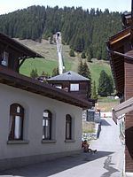
Mürrenbach Fall

The Mürrenbachfall is a waterfall in the Lauterbrunnental in the Bernese Oberland, Switzerland. The Mürrenbach, which rises above Mürren, passes the village on the southern edge of the town and falls here over the high rock walls of the Trogtal almost to the valley floor, is a left tributary of the Weissen Lütschine with a catchment area of three and a half square kilometers. According to studies from 2009, the Mürrenbachfall is considered the highest waterfall in Switzerland with a drop of 417 meters. The Mürrenbachfall, previously known as cascade fall was redefined by geographers into a single case because, upon careful investigation, they could not find any horizontal planes typical of cascades in the case. However, this assignment is not completely clear. The second highest waterfall in Switzerland is the Serenbachfall II, which is 305 meters high.The Mürrenbachfall is not a free-falling waterfall on an overhanging rock like, for example, the Staubbachfall, also located in the Lauterbrunnen Valley, which at 297 meters is considered the highest free-falling waterfall in Switzerland. The water falls down here along the almost vertical rock of the Mürrenfluh. In addition to the main fall, there are various other waterfalls on the Mürrenbach, so that people often talk about the Mürrenbach Falls, which together fall 750 meters deep into the valley in several stages. The impact zone of the main fall is around 920 m. The waterfall is located near the valley station of the cable car to Mürren in Stechelberg, where the Mürrenbach flows into the Lütschine. It can also be clearly seen from the cable car.
Excerpt from the Wikipedia article Mürrenbach Fall (License: CC BY-SA 3.0, Authors, Images).Mürrenbach Fall
Mürreflue - Klettersteig,
Geographical coordinates (GPS) Address Nearby Places Show on map
Geographical coordinates (GPS)
| Latitude | Longitude |
|---|---|
| N 46.55554 ° | E 7.89579 ° |
Address
Mürreflue - Klettersteig
Mürreflue - Klettersteig
3825
Bern, Switzerland
Open on Google Maps


