place

Lauterbrunnen–Mürren Mountain Railway

Bernese OberlandMetre gauge railways in SwitzerlandMountain railwaysRailway companies established in 1891Railway companies of Switzerland
Railway lines in SwitzerlandRailway lines opened in 1891Swiss companies established in 1891Transport in the canton of Bern
Gimmelwald Grütschalp 29.07.2009 15 26 15

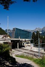
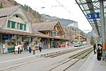
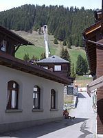
The Lauterbrunnen–Mürren Mountain Railway (German: Bergbahn Lauterbrunnen–Mürren, BLM, also known as Mürrenbahn) is a hybrid transport system in the Bernese Oberland area of Switzerland, which connects the villages of Lauterbrunnen and Mürren. The system consists of a connected aerial cableway, also known as the Grütschalpbahn, and an adhesion worked mountain railway. The cableway replaced a funicular, on the same route, in 2010.The line provides a vital passenger and goods link to the resort village of Mürren, which is situated above the cliffs of the Lauterbrunnen Valley and has poor road access. It also commands a view of the Eiger, Mönch and Jungfrau mountains across the depths of that valley.The line is owned by the Bergbahn Lauterbrunnen-Mürren AG, a subsidiary of the Jungfraubahn Holding AG, a holding company that also owns the Wengernalpbahn, Jungfraubahn, Harderbahn, and Firstbahn. Through that holding company it is part of the Allianz - Jungfrau Top of Europe marketing alliance, which also includes the separately owned Berner Oberland-Bahn and Schynige Platte-Bahn.

Excerpt from the Wikipedia article Lauterbrunnen–Mürren Mountain Railway (License: CC BY-SA 3.0, Authors, Images).

Lauterbrunnen–Mürren Mountain Railway
222,

Geographical coordinates (GPS) Address Nearby Places
placeShow on map

Wikipedia: Lauterbrunnen–Mürren Mountain RailwayContinue reading on Wikipedia

Geographical coordinates (GPS)

Latitude Longitude
N 46.5839 ° E 7.8954 °
placeShow on map

Address

222 898q
3825
Bern, Switzerland
mapOpen on Google Maps

Gimmelwald Grütschalp 29.07.2009 15 26 15
Share experience

Nearby Places

Lauterbrunnen Wall
Lauterbrunnen Wall

The Lauterbrunnen Wall is a term used in the English-speaking mountaineering world to refer to a north-west-facing mountain wall in the Bernese Alps in Switzerland. It runs for 8 kilometres from the Gletscherhorn (3,983 m) in the east, through the Ebnefluh, (3,962 m), the Mittaghorn (3,897m) and the Grosshorn (3,754 m), to the Breithorn (3,785 m) in the west, where the wall comes to an end at the col which separates it from the Tschingelhorn. The Wall is named after the village of Lauterbrunnen, which lies to the north. The Wall has been a popular venue for ice-climbing since the 1930s, when it was tackled by Feuz, von Allmen and Welzenbach. Many of the routes are less frequently attempted today, because of relatively difficult access (in the context of the Alps) and objective danger.On 12 April 2007 a Luftwaffe Tornado stationed in Lechfeld, Bavaria crashed high into the Wall between the Mittaghorn and the Ebnefluh. The jet was "practically pulverized" and the pilot was killed on impact; his weapon systems officer, who ejected, was rescued by the mountain rescue services. The cause of the crash was poor flight planning: The Lauterbrunnen valley is not suitable for military fighter jets because of heavy paraglider, hang glider and helicopter traffic during the day time, and as the jet had refuelled just a short time ago, the configuration of the Tornado was too heavy for the necessary climb rate to clear the Lauterbrunnen Wall. The crew did not violate any regulations during their flight, though.