place

North Branch Millers River

Rivers of Cheshire County, New HampshireRivers of MassachusettsRivers of New HampshireRivers of Worcester County, MassachusettsTributaries of the Connecticut River
North Millers River, Winchendon Springs MA

The North Branch of the Millers River is a river in southwestern New Hampshire and northern Massachusetts in the United States. It is a tributary of the Millers River, which flows west to the Connecticut River, which in turn flows south to Long Island Sound, an arm of the Atlantic Ocean. The North Branch rises in New Ipswich, New Hampshire, at the outlet of Mountain Pond. It flows west through Island Pond into Rindge, and passes the villages of East Rindge and Converseville to Lake Monomonac. From the lake's outlet in Massachusetts, the North Branch flows south parallel to U.S. Route 202, joining the Millers River at Whitney Pond in Winchendon. The North Branch is 6.0 miles (9.7 km) long, 4.0 miles (6.4 km) of which are in New Hampshire, with 2.0 miles (3.2 km) in Massachusetts. If the channel length of 2.9 miles (4.7 km) through Lake Monomonac were included, the total length would be 8.9 miles (14.3 km).

Excerpt from the Wikipedia article North Branch Millers River (License: CC BY-SA 3.0, Authors, Images).

North Branch Millers River
Glenallen Street,

Geographical coordinates (GPS) Address Nearby Places
placeShow on map

Wikipedia: North Branch Millers RiverContinue reading on Wikipedia

Geographical coordinates (GPS)

Latitude Longitude
N 42.681666666667 ° E -72.028055555556 °
placeShow on map

Address

Calvary Cemetery

Glenallen Street
01475
Massachusetts, United States
mapOpen on Google Maps

North Millers River, Winchendon Springs MA
Share experience

Nearby Places

Winchendon Village Historic District

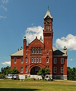
The Winchendon Village Historic District encompasses the 19th-century commercial center of Winchendon, Massachusetts. It extends along Front and School Streets from School Square to Spring Street, and continues north on Central Street as far as Summer Street. This area was developed primarily because of industrialization that took place along Miller's River beginning in the late 18th century and extending into the 1830s, and then expanded further with the arrival of the railroad in the area in the 1840s. This growth caused the area to eclipse the town's colonial town center. The area had risen to sufficient prominence by 1850 that the town hall was built there, which would be followed by other municipal buildings, including the 1913 Beals Memorial Library. The district was listed on the National Register of Historic Places in 1993.Winchendon Village was first known as Morse's Village, and had its beginnings in the construction of a dam and grist mill on the Millers River in 1752. Isaac Morse built a hotel at the junction of Front and Central Streets about 1805, and the area benefited from improved roads in the early 19th century. A fulling mill, established in 1793 on one of the mill privileges, was expanded to produce textiles in the 1820s, and tanneries added to the economic base. The routing of a rail line in 1848 through the village (north of the district, now a rail trail) cemented the village's economic importance in the town. Central Street developed as the commercial hub, and Front Street was lined with the fine houses of local businessmen.