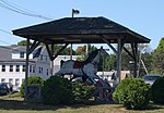
Lake Monomonac

Lake Monomonac is an artificial lake that straddles the border between Rindge, New Hampshire, and Winchendon, Massachusetts, in the United States. It was created from a small pond in New Hampshire by the construction of dams on the North Branch of the Millers River, a part of the Connecticut River watershed. Lake Monomonac is 594 acres (240 ha) in size, with 411 acres (166 ha) in New Hampshire and the remaining 183 acres (74 ha) in Massachusetts. The lake has a maximum recorded depth of 22 feet (6.7 m) and an average depth of 10 feet (3.0 m).The lake is classified as a warmwater fishery, with observed species including smallmouth and largemouth bass, black crappie, chain pickerel, white perch, pumpkinseed, bluegill, horned pout, and green sunfish.
Excerpt from the Wikipedia article Lake Monomonac (License: CC BY-SA 3.0, Authors, Images).Lake Monomonac
La Chance Circle,
Geographical coordinates (GPS) Address Nearby Places Show on map
Geographical coordinates (GPS)
| Latitude | Longitude |
|---|---|
| N 42.7175 ° | E -71.995277777778 ° |
Address
La Chance Circle 52
03461
New Hampshire, United States
Open on Google Maps


