place

Copetown, Ontario

Neighbourhoods in Hamilton, OntarioUse Canadian English from January 2023
Coat of Arms of the Waterdown East Flamborough Heritage Society

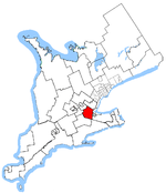
Copetown is a rural neighbourhood of the city of Hamilton, Ontario, Canada, located northeast of Brantford. William Cope, a United Empire Loyalist from the U.S. state of New York settled here in 1794. The community was renamed after his son Conradt in 1851. The current population of this community is approximately 130 residents. This community is located within the 905 area code for telephones and the postal forward sortation area in this region is L0R. Dundas Hill is located nearby, signifying its closeness to Dundas. The community is located 40 miles (64 km) away from Toronto. Copetown is a short eastbound drive away from Flamboro Downs and is located relatively close to downtown Dundas.

Excerpt from the Wikipedia article Copetown, Ontario (License: CC BY-SA 3.0, Authors, Images).

Copetown, Ontario
Highway 52, Hamilton

Geographical coordinates (GPS) Address Nearby Places
placeShow on map

Wikipedia: Copetown, OntarioContinue reading on Wikipedia

Geographical coordinates (GPS)

Latitude Longitude
N 43.244191666667 ° E -80.056372222222 °
placeShow on map

Address

Highway 52 (Hamilton Route 52)

Highway 52
L0R 1J0 Hamilton
Ontario, Canada
mapOpen on Google Maps

Coat of Arms of the Waterdown East Flamborough Heritage Society
Share experience

Nearby Places

Darnley Cascade
Darnley Cascade

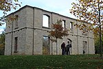
Darnley Cascade is a 4-metre-high (13 ft) cascade waterfall located at Crooks Hollow Conservation Area in Greensville, Hamilton, Ontario, Canada. Nearby attractions include Bruce Trail, Dundas Valley Conservation Area, Spencer Gorge/Webster's Falls Conservation Area, Hermitage ruins, Royal Botanical Gardens, Dundurn Castle, Christie Lake Conservation Area, Dundas Historical Society Museum and Carnegie Gallery.The waterfall got its name from the Darnley Grist Mill, completed in 1813 by Scottish settler James Crooks, who admired Lord Darnley and claimed him as an ancestor. The grist mill was sold to James Stutt after Crooks' death in 1860. Darnley Cascade is sometimes referred to as Stutt's Falls, a name which is used on vintage postcards of the area. The mill burned down in 1934, but the ruins remain.An article published in November 2020 states that the Darnley mill was expanded in 1829 to include "a distillery, a linseed oil mill, a cooperage, a card clothing factory, a fulling and drying works, a tannery, a woollen mill, a foundry, an agricultural implement factory and Upper Canada’s first paper mill". The community also grew in that era, with a general store and inn; residents lived along the valley road. Today, the site "is considered to be one of Ontario’s oldest ruins and is just one of the remains of the early industrial empire of James Crooks and of the community which became Crooks Hollow".Another nearby mill which was destroyed by fire in 1875, also built by James Crooks, is considered to have been "Upper Canada's First Paper Mill (1826)".

Ancaster, Ontario
Ancaster, Ontario

Ancaster is a historic town in the city of Hamilton, Ontario, Canada, located on the Niagara Escarpment. Founded as a town in 1793, it immediately developed itself into one of the first important and influential early British Upper Canada communities established during the late 18th century eventually amalgamating with the city of Hamilton in 2001. By 1823, due in large part to its easily accessible water power and location at the juncture of prehistoric indigenous trading routes, Ancaster had become Upper Canada's largest industrial and commercial centre. Additionally, Ancaster had at that time attracted the 2nd largest populace (1,681) in Upper Canada trailing only Kingston (population 2,500), but surpassing the populations of nearby Toronto (1,376) and Hamilton (1,000). After this initial period of prosperity beginning in the late 18th century, sudden significant water and rail transportation advancements of the early 19th century would soon better benefit Ancaster's neighbouring towns situated closer to the Lake Ontario waterfront. Stationary steam engines for industries that had rapidly developed in the 19th century would eventually make Ancaster's water-powered industries less vital. As a result, after the 1820s, Ancaster's influence during the remainder of the 19th century would begin to wane. From the late 19th century, Ancaster's population would remain static until 1946 when new subdivisions around the village were established. The population expanded further with the completion of the Hamilton-Ancaster section of Highway 403 in 1968 and the introduction of sewer systems in 1974. After 1970, its population has grown steadily from 15,000 residents to its present-day count of 40,557.