place

Jerseyville, Ontario

Neighbourhoods in Hamilton, OntarioOntario geography stubsUse Canadian English from January 2023
JerseyRd
JerseyRd

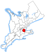
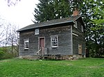
Jerseyville is a dispersed rural community within the city of Hamilton, in Ontario, Canada. The community was initially known as Jersey Settlement, named by the United Empire Loyalist settlers from New Jersey who settled in the late 1790s. but was changed to its present name in 1852 when a post office was opened.Formerly an elementary school, general store, post office, train station and a motorcycle dealership. Jerseyville's former elementary school is currently home to Circus Orange, and the general store is home to Black & Smith Country General.The Brantford to Hamilton rail trail passes through Jerseyville in place of the old train tracks. The original Jerseyville train station building can be found at Westfield Heritage Village in Rockton.

Excerpt from the Wikipedia article Jerseyville, Ontario (License: CC BY-SA 3.0, Authors, Images).

Jerseyville, Ontario
Union Street, Hamilton

Geographical coordinates (GPS) Address Nearby Places
placeShow on map

Wikipedia: Jerseyville, OntarioContinue reading on Wikipedia

Geographical coordinates (GPS)

Latitude Longitude
N 43.199166666667 ° E -80.106111111111 °
placeShow on map

Address

Union Street 20
L0R 1T0 Hamilton
Ontario, Canada
mapOpen on Google Maps

JerseyRd
JerseyRd
Share experience

Nearby Places

Cainsville, Ontario

Cainsville is a community straddling the boundary of Brantford and Brant County in Ontario, Canada. Cainsville started off as a rural Black Canadian settlement called Bunnell's Landing. Joseph Brant had given an initial land grant to a handful of free, formerly enslaved Africans. Throughout the 1800s other black settlers, who were not part of the original land grant, purchased land in the area to be close to a larger black community. Most of the settlers were African American freedom seekers or descendants of those who had escaped to the area through the Underground Railroad. It was named after Peter Cain, one of the first settlers, and was laid out in 1837.Ontario Highway 53, runs through the community. This was the main East-West provincial highway until the completion of Highway 403 in 1997, which reduced the use of Highway 53 to local traffic. The Hamilton–Brantford–Cambridge Trails, part of the Southern loop of the Trans Canada Trail runs through Cainsville. A commemorative plaque in the area reads:Bunnell’s Landing: Early Black Settlement When Joseph Brant and his supporters came to Canada from New York in 1784 they brought their American slaves with them to the Grand River Valley. Slavery was abolished in the British Empire by 1834 and so most of the Black families stayed here and settled along the river near Cainsville. Fugitive slaves from the South later joined them, coming through Buffalo across Lake Erie and then up the Grand River. Until the Grand River Navigation Company locks were built in 1848, this site was as far up the river as cargo boats could travel. Later the Toronto, Hamilton and Buffalo Railways shipped goods from Brantford’s factories along this rail line. The landslide of 1986 destroyed the tracks and buried most evidence of settlement in this area. Across the river from Bunnell’s Landing is Bow Park Farm, the home of George Brown (1818-1880), Journalist and Statesman. He was founder of the Canadian Liberal Party and of the Toronto Globe Newspaper. He also played an important role in Confederation.

Ancaster, Ontario
Ancaster, Ontario

Ancaster is a historic town in the city of Hamilton, Ontario, Canada, located on the Niagara Escarpment. Founded as a town in 1793, it immediately developed itself into one of the first important and influential early British Upper Canada communities established during the late 18th century eventually amalgamating with the city of Hamilton in 2001. By 1823, due in large part to its easily accessible water power and location at the juncture of prehistoric indigenous trading routes, Ancaster had become Upper Canada's largest industrial and commercial centre. Additionally, Ancaster had at that time attracted the 2nd largest populace (1,681) in Upper Canada trailing only Kingston (population 2,500), but surpassing the populations of nearby Toronto (1,376) and Hamilton (1,000). After this initial period of prosperity beginning in the late 18th century, sudden significant water and rail transportation advancements of the early 19th century would soon better benefit Ancaster's neighbouring towns situated closer to the Lake Ontario waterfront. Stationary steam engines for industries that had rapidly developed in the 19th century would eventually make Ancaster's water-powered industries less vital. As a result, after the 1820s, Ancaster's influence during the remainder of the 19th century would begin to wane. From the late 19th century, Ancaster's population would remain static until 1946 when new subdivisions around the village were established. The population expanded further with the completion of the Hamilton-Ancaster section of Highway 403 in 1968 and the introduction of sewer systems in 1974. After 1970, its population has grown steadily from 15,000 residents to its present-day count of 40,557.