place

Dundas Valley Conservation Area

Conservation areas in OntarioDundas, OntarioNature centres in OntarioNiagara EscarpmentProtected areas of Hamilton, Ontario
DundasValleyPark
DundasValleyPark

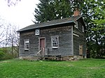
Dundas Valley Conservation Area is located on the Niagara Escarpment in Dundas, Ontario, a constituent community of Hamilton, Ontario, and is owned and operated by the Hamilton Conservation Authority. Its 40-kilometre trail system provides a connection to the Bruce Trail. The area contains a trailhead of the Hamilton-Brantford-Cambridge Trails, Canada's first fully developed interurban multi-use trail system, which is a part of the Trans Canada Trail.

Excerpt from the Wikipedia article Dundas Valley Conservation Area (License: CC BY-SA 3.0, Authors, Images).

Dundas Valley Conservation Area
Main Loop (Bruce Trail), Hamilton Ancaster

Geographical coordinates (GPS) Address Nearby Places
placeShow on map

Wikipedia: Dundas Valley Conservation AreaContinue reading on Wikipedia

Geographical coordinates (GPS)

Latitude Longitude
N 43.2375 ° E -79.993888888889 °
placeShow on map

Address

Main Loop (Bruce Trail)

Main Loop (Bruce Trail)
L9G 1L8 Hamilton, Ancaster
Ontario, Canada
mapOpen on Google Maps

DundasValleyPark
DundasValleyPark
Share experience

Nearby Places

Ancaster, Ontario
Ancaster, Ontario

Ancaster is a historic town in the city of Hamilton, Ontario, Canada, located on the Niagara Escarpment. Founded as a town in 1793, it immediately developed itself into one of the first important and influential early British Upper Canada communities established during the late 18th century eventually amalgamating with the city of Hamilton in 2001. By 1823, due in large part to its easily accessible water power and location at the juncture of prehistoric indigenous trading routes, Ancaster had become Upper Canada's largest industrial and commercial centre. Additionally, Ancaster had at that time attracted the 2nd largest populace (1,681) in Upper Canada trailing only Kingston (population 2,500), but surpassing the populations of nearby Toronto (1,376) and Hamilton (1,000). After this initial period of prosperity beginning in the late 18th century, sudden significant water and rail transportation advancements of the early 19th century would soon better benefit Ancaster's neighbouring towns situated closer to the Lake Ontario waterfront. Stationary steam engines for industries that had rapidly developed in the 19th century would eventually make Ancaster's water-powered industries less vital. As a result, after the 1820s, Ancaster's influence during the remainder of the 19th century would begin to wane. From the late 19th century, Ancaster's population would remain static until 1946 when new subdivisions around the village were established. The population expanded further with the completion of the Hamilton-Ancaster section of Highway 403 in 1968 and the introduction of sewer systems in 1974. After 1970, its population has grown steadily from 15,000 residents to its present-day count of 40,557.