place

Ancaster—Dundas—Flamborough—Westdale

Former federal electoral districts of OntarioPolitics of Hamilton, Ontario
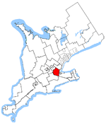
Ancaster Dundas Flamborough Westdale (riding map)

Ancaster—Dundas—Flamborough—Westdale was a federal electoral district in Ontario, Canada, that has been represented in the House of Commons of Canada from 2004 until the electoral boundaries were redrawn for the 2015 election. The district included the western half of the amalgamated city of Hamilton but did not include any of the city centre. It did, however, include McMaster University, Redeemer University College and many of the neighbourhoods surrounding it.

Excerpt from the Wikipedia article Ancaster—Dundas—Flamborough—Westdale (License: CC BY-SA 3.0, Authors, Images).

Ancaster—Dundas—Flamborough—Westdale
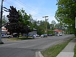
Middletown Road, Hamilton

Geographical coordinates (GPS) Address Nearby Places
placeShow on map

Wikipedia: Ancaster—Dundas—Flamborough—WestdaleContinue reading on Wikipedia

Geographical coordinates (GPS)

Latitude Longitude
N 43.2605 ° E -80.0251 °
placeShow on map

Address

Middletown Road

Middletown Road
L9H 5E2 Hamilton
Ontario, Canada
mapOpen on Google Maps

Ancaster Dundas Flamborough Westdale (riding map)
Share experience

Nearby Places

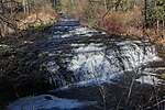
Darnley Cascade
Darnley Cascade

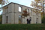
Darnley Cascade is a 4-metre-high (13 ft) cascade waterfall located at Crooks Hollow Conservation Area in Greensville, Hamilton, Ontario, Canada. Nearby attractions include Bruce Trail, Dundas Valley Conservation Area, Spencer Gorge/Webster's Falls Conservation Area, Hermitage ruins, Royal Botanical Gardens, Dundurn Castle, Christie Lake Conservation Area, Dundas Historical Society Museum and Carnegie Gallery.The waterfall got its name from the Darnley Grist Mill, completed in 1813 by Scottish settler James Crooks, who admired Lord Darnley and claimed him as an ancestor. The grist mill was sold to James Stutt after Crooks' death in 1860. Darnley Cascade is sometimes referred to as Stutt's Falls, a name which is used on vintage postcards of the area. The mill burned down in 1934, but the ruins remain.An article published in November 2020 states that the Darnley mill was expanded in 1829 to include "a distillery, a linseed oil mill, a cooperage, a card clothing factory, a fulling and drying works, a tannery, a woollen mill, a foundry, an agricultural implement factory and Upper Canada’s first paper mill". The community also grew in that era, with a general store and inn; residents lived along the valley road. Today, the site "is considered to be one of Ontario’s oldest ruins and is just one of the remains of the early industrial empire of James Crooks and of the community which became Crooks Hollow".Another nearby mill which was destroyed by fire in 1875, also built by James Crooks, is considered to have been "Upper Canada's First Paper Mill (1826)".