Upper Bush
Kent geography stubsVillages in Kent

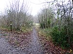
Upper Bush is a hamlet in the parish of Cuxton, in the unitary authority of Medway, in Kent, England. The hamlet has only a few houses, including two Grade II listed buildings; Barrow Hill House and High Birch The North Downs Way long-distance path leads through the village, between Cuxton and Upper Halling.
Excerpt from the Wikipedia article Upper Bush (License: CC BY-SA 3.0, Authors, Images).Upper Bush
Upper Bush Road,
Geographical coordinates (GPS) Address Nearby Places Show on map
Geographical coordinates (GPS)
| Latitude | Longitude |
|---|---|
| N 51.3753 ° | E 0.43439 ° |
Address
Upper Bush Road
Upper Bush Road
ME2 1HQ , Cuxton
England, United Kingdom
Open on Google Maps


