Halling, Kent
MedwayPlaces in Medway

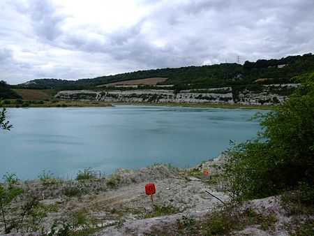
Halling is a village on the North Downs in the northern part of Kent, England. Consisting of Lower Halling, Upper Halling and North Halling, it is scattered over some 3 miles (5 km) along the River Medway parallel to the Pilgrims' Way which runs through Kent. The origin of the name is uncertain. The following have been proposed at various times: Halls land (belonging to Hall), Heall land (from Old English, Hall Manor), Heallgemot (the court of the lord of the Manor) and Heallingas (companions sharing the same hall).
Excerpt from the Wikipedia article Halling, Kent (License: CC BY-SA 3.0, Authors, Images).Halling, Kent
Kent Road,
Geographical coordinates (GPS) Address Nearby Places Show on map
Geographical coordinates (GPS)
| Latitude | Longitude |
|---|---|
| N 51.353333333333 ° | E 0.44388888888889 ° |
Address
Kent Road
Kent Road
ME2 1AR , Halling
England, United Kingdom
Open on Google Maps


