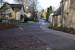
Daglingworth
Use British English from March 2015Villages in Gloucestershire

Daglingworth is a Gloucestershire village in the valley of the River Dunt, near the A417 road connecting Gloucester and Cirencester. As with many smaller villages in the Cotswolds, most of the buildings are now private houses. Other properties are the church, the village hall, a stable & horse riding centre and Bridge Farm. The Church of the Holy Rood in the village is an Anglo-Saxon church with well-preserved stone carvings, including an Anglo-Saxon crucifixion tablet dating to 1015. There is also a canonical sundial on the south wall. The population taken at the 2011 census was 265.
Excerpt from the Wikipedia article Daglingworth (License: CC BY-SA 3.0, Authors, Images).Daglingworth
Cotswold District Duntisbourne Rouse
Geographical coordinates (GPS) Address Nearby Places Show on map
Geographical coordinates (GPS)
| Latitude | Longitude |
|---|---|
| N 51.75 ° | E -2.0166666666667 ° |
Address
GL7 7AA Cotswold District, Duntisbourne Rouse
England, United Kingdom
Open on Google Maps


