place

Five Mile House, Duntisbourne Abbots

Commercial buildings completed in the 17th centuryCotswold DistrictFormer pubs in GloucestershireGloucestershire building and structure stubsGrade II listed pubs in Gloucestershire
National Inventory PubsPub stubsUnited Kingdom listed building stubsUse British English from August 2014
The Five Mile House (geograph 3704269)

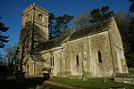
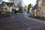
The Five Mile House is a former pub on Old Gloucester Road, Duntisbourne Abbots, Gloucestershire, England. It was built in the 17th century and is grade II listed.The pub was on the Campaign for Real Ale's National Inventory of Historic Pub Interiors.The inn is on the old Roman road of Ermin Street. Documents found from 1891 and 1903 referred to the pub as the Old Inn. The Five Mile House was owned and operated by the Ruck family from the 1930s until Ivy Ruck's death in 1995. The pub had bare wood floors, open fires and wooden seating, with a small bar leading through to the tap room. The pub was bought and refurbished by the Carrier family, and reopened in 1997. It closed in 2015, after the re-routing of the A419 had diverted much of the passing custom away. The building was converted into a private residence.

Excerpt from the Wikipedia article Five Mile House, Duntisbourne Abbots (License: CC BY-SA 3.0, Authors, Images).

Five Mile House, Duntisbourne Abbots
Gloucester Road, Cotswold District Duntisbourne Abbots

Geographical coordinates (GPS) Address Nearby Places
placeShow on map

Wikipedia: Five Mile House, Duntisbourne AbbotsContinue reading on Wikipedia

Geographical coordinates (GPS)

Latitude Longitude
N 51.782043 ° E -2.034221 °
placeShow on map

Address

Gloucester Road

Gloucester Road
GL7 7JR Cotswold District, Duntisbourne Abbots
England, United Kingdom
mapOpen on Google Maps

The Five Mile House (geograph 3704269)
Share experience

Nearby Places

Cotswolds
Cotswolds

The Cotswolds ( KOTS-wohldz, KOTS-wəldz) is a region in central, South East, but predominantly South West England, along a range of rolling hills that rise from the meadows of the upper River Thames to an escarpment above the Severn Valley, Bath and Evesham Vale. The area is defined by the bedrock of Jurassic limestone that creates a type of grassland habitat rare in the UK and that is quarried for the golden-coloured Cotswold stone. The predominantly rural landscape contains stone-built villages, towns, stately homes and gardens featuring the local stone. Designated as an Area of Outstanding Natural Beauty (AONB) in 1966, the Cotswolds covers 787 square miles (2,038 km2), making it the largest AONB. It is England's third-largest protected landscape, after the Lake District and Yorkshire Dales national parks. Its boundaries are roughly 25 miles (40 km) across and 90 miles (140 km) long, stretching south-west from just south of Stratford-upon-Avon to just south of Bath, near Radstock. It lies across the boundaries of several English counties; mainly Gloucestershire and Oxfordshire, and parts of Wiltshire, Somerset, Worcestershire, and Warwickshire. The region's highest point is Cleeve Hill at 1,083 ft (330 m), just east of Cheltenham. The hills give their name to the Cotswold local government district, formed on 1 April 1974, within the county of Gloucestershire. Its main town is Cirencester, where the Cotswold District Council offices are. As of 2021, the population of the 450-square-mile (1,200 km2) district was about 91,000 . The much larger area referred to as the Cotswolds encompasses nearly 800 square miles (2,100 km2). The population of the Area of Outstanding Natural Beauty was 139,000 in 2016.