place

Duntisbourne Abbots

Cotswold DistrictGloucestershire geography stubsUse British English from March 2015Villages in Gloucestershire
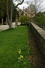
Davenport House, Duntisbourne Abbots

Duntisbourne Abbots is a village and civil parish located in the English county of Gloucestershire. Duntisbourne Abbots forms part of the Cotswold District. The Five Mile House is a 17th-century Grade II listed public house at Old Gloucester Road. It is on the Campaign for Real Ale's National Inventory of Historic Pub Interiors.St Peter's Church in the village was built in the 12th century, on the site of an earlier, Saxon, church. Its tower dates from Norman times, and has belfry lights of pierced stone lattice work that date from the 13th century. Inside the church, the font also dates from Norman times, while the unusual chancel arch dates from an extensive Victorian restoration.It also features in the title of µ-Ziq's 2007 album Duntisbourne Abbots Soulmate Devastation Technique.

Excerpt from the Wikipedia article Duntisbourne Abbots (License: CC BY-SA 3.0, Authors, Images).

Duntisbourne Abbots
Cotswold District Duntisbourne Abbots

Geographical coordinates (GPS) Address Nearby Places
placeShow on map

Wikipedia: Duntisbourne AbbotsContinue reading on Wikipedia

Geographical coordinates (GPS)

Latitude Longitude
N 51.76919 ° E -2.04365 °
placeShow on map

Address


GL7 7JN Cotswold District, Duntisbourne Abbots
England, United Kingdom
mapOpen on Google Maps

Davenport House, Duntisbourne Abbots
Share experience

Nearby Places

Cotswolds
Cotswolds

The Cotswolds ( KOTS-wohldz, KOTS-wəldz) is a region in central, South East, but predominantly South West England, along a range of rolling hills that rise from the meadows of the upper River Thames to an escarpment above the Severn Valley, Bath and Evesham Vale. The area is defined by the bedrock of Jurassic limestone that creates a type of grassland habitat rare in the UK and that is quarried for the golden-coloured Cotswold stone. The predominantly rural landscape contains stone-built villages, towns, stately homes and gardens featuring the local stone. Designated as an Area of Outstanding Natural Beauty (AONB) in 1966, the Cotswolds covers 787 square miles (2,038 km2), making it the largest AONB. It is England's third-largest protected landscape, after the Lake District and Yorkshire Dales national parks. Its boundaries are roughly 25 miles (40 km) across and 90 miles (140 km) long, stretching south-west from just south of Stratford-upon-Avon to just south of Bath, near Radstock. It lies across the boundaries of several English counties; mainly Gloucestershire and Oxfordshire, and parts of Wiltshire, Somerset, Worcestershire, and Warwickshire. The region's highest point is Cleeve Hill at 1,083 ft (330 m), just east of Cheltenham. The hills give their name to the Cotswold local government district, formed on 1 April 1974, within the county of Gloucestershire. Its main town is Cirencester, where the Cotswold District Council offices are. As of 2021, the population of the 450-square-mile (1,200 km2) district was about 91,000 . The much larger area referred to as the Cotswolds encompasses nearly 800 square miles (2,100 km2). The population of the Area of Outstanding Natural Beauty was 139,000 in 2016.