place

Molenbeek-Saint-Jean Municipal Hall

Belgian building and structure stubsBuildings and structures in BrusselsCity and town halls in BelgiumCommons category link is locally definedGovernment buildings completed in 1886
Molenbeek-Saint-JeanProtected heritage sites in BrusselsUse British English from July 2023
Gemeentehuis St Jans Molenbeek

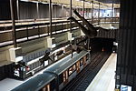
The Municipal Hall (French: Hôtel communal, Dutch: Gemeentehuis) of Molenbeek-Saint-Jean is the municipal hall building and the seat of that municipality of Brussels, Belgium. Designed by the architect Jean-Baptiste Janssens and completed in 1886, it is located at 20, rue du Comte de Flandre/Graaf van Vlaanderenstraat. This site is served by Comte de Flandre/Graaf van Vlaanderen metro station on line 5 of the Brussels Metro.

Excerpt from the Wikipedia article Molenbeek-Saint-Jean Municipal Hall (License: CC BY-SA 3.0, Authors, Images).

Molenbeek-Saint-Jean Municipal Hall
Rue du Comte de Flandre - Graaf van Vlaanderenstraat,

Geographical coordinates (GPS) Address Website Nearby Places
placeShow on map

Wikipedia: Molenbeek-Saint-Jean Municipal HallContinue reading on Wikipedia

Geographical coordinates (GPS)

Latitude Longitude
N 50.8552 ° E 4.3387 °
placeShow on map

Address

Maison communale de Molenbeek-Saint-Jean - Gemeentehuis van Sint-Jans-Molenbeek

Rue du Comte de Flandre - Graaf van Vlaanderenstraat 20
1080
Belgium
mapOpen on Google Maps

Website
molenbeek.irisnet.be

linkVisit website

Gemeentehuis St Jans Molenbeek
Share experience

Nearby Places

Brussels Canal
Brussels Canal

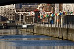
The Brussels Canal (French: Canal de Bruxelles, Dutch: Kanaal van Brussel) is a section of waterway in Brussels, Belgium. It generally refers to the northernmost portion of the Brussels–Charleroi Canal (from the Ninove Gate to the Sainctelette area) and the southernmost section of the Brussels–Scheldt Maritime Canal or Willebroek Canal (between Sainctelette and the Vergote Dock).The Brussels Canal divides the City of Brussels from the municipality of Molenbeek-Saint-Jean, forming the border between them. Previously (before the 19th century, when the canal was dug), there used to be a Willebroek Canal through which a series of locks eventually reached the Brussels harbour inside the city. There used to also be a small canal connecting the Willebroek Canal along the western portion of the city's old defensive walls to the two arms of the river Senne, which were later was covered over and the entire river redirected underground for its entire course within inner Brussels. In the 20th century, even the underground course of the river was altered and the city centre river bedding was dried, the water redirected away from the centre and moved along the western side of the Small Ring (inner ring road), thus also along the Brussels Canal. The Brussels Canal features several turning basins in its urban course. As part of multiple public works projects, including the covering of the Senne, excess water from the underground flowing river is drained into the canal.