Scheldt
1520s disestablishments in the Holy Roman Empire1528 disestablishments in EuropeInternational rivers of EuropePages including recorded pronunciationsPages with Dutch IPA ... and 19 more
Pages with French IPARamsar sites in BelgiumRamsar sites in Metropolitan FranceRamsar sites in the NetherlandsRivers of AisneRivers of Antwerp ProvinceRivers of BelgiumRivers of East FlandersRivers of FlandersRivers of FranceRivers of Hainaut (province)Rivers of Hauts-de-FranceRivers of Nord (French department)Rivers of WalloniaRivers of West FlandersRivers of ZeelandRivers of the NetherlandsRivers of the Rhine–Meuse–Scheldt deltaScheldt basin

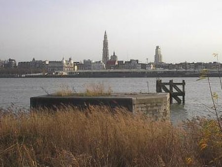
The Scheldt ( SHELT, SKELT; French: Escaut [ɛsko]; Dutch: Schelde [ˈsxɛldə] ) is a 435-kilometre-long (270 mi) river that flows through northern France, western Belgium, and the southwestern part of the Netherlands, with its mouth at the North Sea. Its name is derived from an adjective corresponding to Old English sċeald ("shallow"), Modern English shoal, Low German schol, West Frisian skol, and obsolete Swedish skäll ("thin").
Excerpt from the Wikipedia article Scheldt (License: CC BY-SA 3.0, Authors, Images).Scheldt
Geographical coordinates (GPS) Address Nearby Places Show on map
Geographical coordinates (GPS)
| Latitude | Longitude |
|---|---|
| N 51.430833333333 ° | E 3.5288888888889 ° |
Address
Vlissingen
(Vlissingen)
Zeeland, Netherlands
Open on Google Maps


