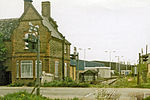
Poyle
Places formerly in MiddlesexSuburbs of SloughUse British English from December 2013Villages in Berkshire

Poyle is a largely industrial and agricultural area in the unitary authority of Slough, in the ceremonial county of Berkshire, England (of which it is the easternmost settlement). It is located 18.5 miles (30 km) west of Charing Cross in London and immediately west of the M25 motorway, near Heathrow Airport; it also adjoins the Colne Valley regional park. Historically in Middlesex, Poyle was transferred to Surrey in 1965 and to Berkshire in 1995. Together with the neighbouring village of Colnbrook to the west, it forms the Colnbrook with Poyle civil parish.
Excerpt from the Wikipedia article Poyle (License: CC BY-SA 3.0, Authors, Images).Poyle
Meadowbrook Close,
Geographical coordinates (GPS) Address Nearby Places Show on map
Geographical coordinates (GPS)
| Latitude | Longitude |
|---|---|
| N 51.4779 ° | E -0.5087 ° |
Address
Meadowbrook Close
SL3 0PA , Colnbrook with Poyle
England, United Kingdom
Open on Google Maps


