place

Carteret School District

Carteret, New JerseyNew Jersey District Factor Group BSchool districts in Middlesex County, New JerseyUse American English from January 2023Use mdy dates from January 2023

The Carteret School District is a comprehensive community public school district that serves students in pre-kindergarten through twelfth grade from Carteret, in Middlesex County, New Jersey, United States.As of the 2021–22 school year, the district, comprised of five schools, had an enrollment of 3,882 students and 305.4 classroom teachers (on an FTE basis), for a student–teacher ratio of 12.7:1.The district is classified by the New Jersey Department of Education as being in District Factor Group "B", the second-lowest of eight groupings. District Factor Groups organize districts statewide to allow comparison by common socioeconomic characteristics of the local districts. From lowest socioeconomic status to highest, the categories are A, B, CD, DE, FG, GH, I and J.

Excerpt from the Wikipedia article Carteret School District (License: CC BY-SA 3.0, Authors).

Carteret School District
Roosevelt Avenue,

Geographical coordinates (GPS) Address Website External links Nearby Places
placeShow on map

Wikipedia: Carteret School DistrictContinue reading on Wikipedia

Geographical coordinates (GPS)

Latitude Longitude
N 40.583577 ° E -74.218716 °
placeShow on map

Address

Carteret Board of Education (Carteret Board of Education Administrative Offices;Carteret Public Schools)

Roosevelt Avenue
07008
New Jersey, United States
mapOpen on Google Maps

Website
carteretschools.org

linkVisit website

linkWikiData (Q5047239)
linkOpenStreetMap (1037860942)

Share experience

Nearby Places

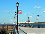
Hudson River Waterfront Walkway

The Hudson River Waterfront Walkway, also known as the Hudson River Walkway, is a promenade along the Hudson Waterfront in New Jersey. The ongoing and incomplete project located on Kill van Kull and the western shore of Upper New York Bay and the Hudson River was implemented as part of a New Jersey state-mandated master plan to connect the municipalities from the Bayonne Bridge to the George Washington Bridge with an urban linear park and provide contiguous unhindered access to the water's edge. There is no projected date for its completion, though large segments have been built or incorporated into it since its inception. The southern end in Bayonne may eventually connect to the Hackensack RiverWalk, another proposed walkway along Newark Bay and Hackensack River on the west side of the Hudson County peninsula, and form part of a proposed Harbor Ring around the harbor. Its northern end is in Palisades Interstate Park, allowing users to continue along the river bank and alpine paths to the New Jersey/New York state line and beyond. (A connection to the Long Path, a 330-mile (530 km) hiking trail with terminus near Albany, is feasible.) As of 2007, eleven miles (18 km) of walkway have been completed, with an additional five miles (8 km) designated HRWW along Broadway in Bayonne. A part of the East Coast Greenway, or ECG, a project to create a nearly 3000-mile (4828 km) urban path linking the major cities along the Atlantic coast runs concurrent with the HRWW.In 2013 the walkway showed signs of age. Some of the pilings on which it is built succumbed to marine worms and effects of Hurricane Sandy in New Jersey, which undermined bedding.