place

Yeshiva Gedola of Carteret

2006 establishments in New JerseyCarteret, New JerseyEducational institutions established in 2006Haredi Judaism in New JerseyKollelim
Lithuanian-Jewish culture in the United StatesMen's universities and colleges in the United StatesOrthodox yeshivas in New JerseySeminaries and theological colleges in New JerseyUniversities and colleges in Middlesex County, New Jersey

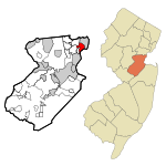
Yeshiva Gedola and Mesivta of Carteret (Hebrew: ישיבה תפארת יהודה אריה) informally, "YGOC", also called Yeshiva Tiferes Yehuda Aryeh, is a yeshiva and non-profit organization located in Carteret in Middlesex County, New Jersey, United States.

Excerpt from the Wikipedia article Yeshiva Gedola of Carteret (License: CC BY-SA 3.0, Authors).

Yeshiva Gedola of Carteret
Noe Street,

Geographical coordinates (GPS) Address Nearby Places
placeShow on map

Wikipedia: Yeshiva Gedola of CarteretContinue reading on Wikipedia

Geographical coordinates (GPS)

Latitude Longitude
N 40.5811 ° E -74.2219 °
placeShow on map

Address

Noe Street 82
07008
New Jersey, United States
mapOpen on Google Maps

Share experience

Nearby Places

Hudson River Waterfront Walkway

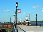
The Hudson River Waterfront Walkway, also known as the Hudson River Walkway, is a promenade along the Hudson Waterfront in New Jersey. The ongoing and incomplete project located on Kill van Kull and the western shore of Upper New York Bay and the Hudson River was implemented as part of a New Jersey state-mandated master plan to connect the municipalities from the Bayonne Bridge to the George Washington Bridge with an urban linear park and provide contiguous unhindered access to the water's edge. There is no projected date for its completion, though large segments have been built or incorporated into it since its inception. The southern end in Bayonne may eventually connect to the Hackensack RiverWalk, another proposed walkway along Newark Bay and Hackensack River on the west side of the Hudson County peninsula, and form part of a proposed Harbor Ring around the harbor. Its northern end is in Palisades Interstate Park, allowing users to continue along the river bank and alpine paths to the New Jersey/New York state line and beyond. (A connection to the Long Path, a 330-mile (530 km) hiking trail with terminus near Albany, is feasible.) As of 2007, eleven miles (18 km) of walkway have been completed, with an additional five miles (8 km) designated HRWW along Broadway in Bayonne. A part of the East Coast Greenway, or ECG, a project to create a nearly 3000-mile (4828 km) urban path linking the major cities along the Atlantic coast runs concurrent with the HRWW.In 2013 the walkway showed signs of age. Some of the pilings on which it is built succumbed to marine worms and effects of Hurricane Sandy in New Jersey, which undermined bedding.