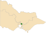
Doncaster East, Victoria
Suburbs of MelbourneSuburbs of the City of ManninghamUse Australian English from August 2019

Doncaster East is a suburb of Melbourne, Victoria, Australia, 20 km east of Melbourne's Central Business District, located within the City of Manningham local government area. Doncaster East recorded a population of 30,926 at the 2021 census.It is located in the hills between the Koonung Creek and the Mullum Mullum Creek. The suburb, which is situated on 11.4km2 of land, Doncaster East occupies a larger area than Doncaster, that they split from. Doncaster East is shaped like a reverse L, with the north-south part connecting with the Yarra River.
Excerpt from the Wikipedia article Doncaster East, Victoria (License: CC BY-SA 3.0, Authors, Images).Doncaster East, Victoria
Nonda Avenue, Melbourne Doncaster East
Geographical coordinates (GPS) Address Nearby Places Show on map
Geographical coordinates (GPS)
| Latitude | Longitude |
|---|---|
| N -37.783 ° | E 145.166 ° |
Address
Nonda Avenue
3109 Melbourne, Doncaster East
Victoria, Australia
Open on Google Maps


