place

Cadley Lock

Canals in WiltshireGrade II listed buildings in WiltshireGrade II listed canalsLocks on the Kennet and Avon CanalUnited Kingdom canal stubs
Use British English from December 2016Wiltshire building and structure stubs
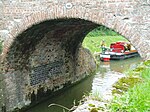
Kennet and Avon Canal, Wootton Rivers looking north east geograph.org.uk 345774

Wootton Top Lock (previously known as Cadley Lock) is a lock on the Kennet and Avon Canal at Wootton Rivers, Wiltshire, England, built c.1810. The lock has a rise/fall of 8 ft 0 in (2.43 m). The lock and bridge are Grade II listed structures.East of this lock is the summit of the canal, at 450 ft (137 m) above sea level. Downstream in the same parish are the locks of Brimslade, Heathy Close, and Wootton Rivers Bottom.

Excerpt from the Wikipedia article Cadley Lock (License: CC BY-SA 3.0, Authors, Images).

Geographical coordinates (GPS)

Latitude Longitude
N 51.36927 ° E -1.69685 °
placeShow on map

Address


SN8 4NF , Wootton Rivers
England, United Kingdom
mapOpen on Google Maps

Kennet and Avon Canal, Wootton Rivers looking north east geograph.org.uk 345774
Share experience

Nearby Places

Bruce Tunnel
Bruce Tunnel

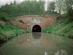
The Bruce Tunnel is on the summit pound of the Kennet and Avon Canal between Wootton Top Lock and Crofton Locks in Wiltshire, England. The tunnel is 502 yards (459 m) long. It is named after Thomas Brudenell-Bruce, 1st Earl of Ailesbury (1729–1814), the local landowner, who, when the canal was being built, would not allow a deep cutting through his land, and insisted on a tunnel instead. At the eastern end of the tunnel is a plaque commemorating its construction: The tunnel has red brick portals, capped with Bath stone, each with a decorative plaque of Pennant stone. Construction was begun in 1806 and finished in 1809. It is lined with English bond brickwork and has a wide bore to cope with the 'Newbury Barges' used on this canal. There is no towpath through the tunnel, so walkers and cyclists must walk across the top of the hill. When canal boats were still pulled by horses, the boatmen had to haul boats through the tunnel by hand, pulling on chains that ran along the inside walls. The tunnel is about 1.3 miles (2 km) north of Burbage village. To the north lies the Savernake Forest which is open to the public with footpaths, drives and picnic sites, hence the tunnel is also sometimes known as the Savernake Tunnel. The main Paddington to Penzance 'Berks and Hants' railway line crosses the tunnel diagonally; both portals can be seen (from different points along the railway) from the windows of passing trains with the canal running close to the railway at each end.