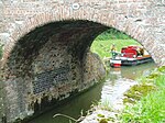
Wootton Rivers Lock
Canals in WiltshireGeorgian architecture in WiltshireGrade II listed buildings in WiltshireGrade II listed canalsLocks on the Kennet and Avon Canal ... and 3 more
United Kingdom canal stubsUse British English from December 2016Wiltshire building and structure stubs

Wootton Rivers Lock, also called Wootton Rivers Bottom Lock, is a lock on the Kennet and Avon Canal at Wootton Rivers, Wiltshire, England. Wootton Rivers Bottom Lock was built during the canal's construction between 1794 and 1810. The lock has a rise/fall of 8 ft 0 in (2.43 m). The parish of Wootton Rivers has three more locks upstream: Heathy Close, Brimslade, and Wootton Top Lock. The lock and its road bridge are Grade II listed.
Excerpt from the Wikipedia article Wootton Rivers Lock (License: CC BY-SA 3.0, Authors, Images).Wootton Rivers Lock
Somerset Cottages,
Geographical coordinates (GPS) Address Nearby Places Show on map
Geographical coordinates (GPS)
| Latitude | Longitude |
|---|---|
| N 51.36482 ° | E -1.71699 ° |
Address
Somerset Cottages
SN8 4NN , Wootton Rivers
England, United Kingdom
Open on Google Maps


