Parkrose, Portland, Oregon
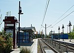
Parkrose is a neighborhood in the Northeast section of Portland, Oregon, and is considered part of East Portland. It is bordered by Sumner to the west, the Columbia River to the north, Argay to the east, and Parkrose Heights and the city of Maywood Park to the south. Sandy Boulevard crosses the neighborhood, with a primarily industrial area prevailing to the north and primarily residential area to the south. There is a Parkrose/Sumner Transit Center, which is served by the Red Line of TriMet's MAX Light Rail. A bridge at the transit center spans Interstate 205. C-Tran serves the transit center and travels into Washington. There is also a Parkrose School District.
Excerpt from the Wikipedia article Parkrose, Portland, Oregon (License: CC BY-SA 3.0, Authors).Parkrose, Portland, Oregon
Northeast Wygant Street, Portland Parkrose
Geographical coordinates (GPS) Address Nearby Places Show on map
Geographical coordinates (GPS)
| Latitude | Longitude |
|---|---|
| N 45.55719 ° | E -122.54745 ° |
Address
Northeast Wygant Street 11152
97220 Portland, Parkrose
Oregon, United States
Open on Google Maps


