place

Bridge Street (Manhattan)

Financial District, ManhattanNew York City road stubsStreets in Manhattan

Bridge Street is a street in the Financial District of Lower Manhattan in New York City, running two blocks from State Street in the west to Broad Street in the east. It intersects Whitehall Street.

Excerpt from the Wikipedia article Bridge Street (Manhattan) (License: CC BY-SA 3.0, Authors).

Bridge Street (Manhattan)
Bridge Street, New York Manhattan

Geographical coordinates (GPS) Address Nearby Places
placeShow on map

Wikipedia: Bridge Street (Manhattan)Continue reading on Wikipedia

Geographical coordinates (GPS)

Latitude Longitude
N 40.703552777778 ° E -74.012955555556 °
placeShow on map

Address

Bridge Street 16
10004 New York, Manhattan
New York, United States
mapOpen on Google Maps

Share experience

Nearby Places

Alexander Hamilton U.S. Custom House

The Alexander Hamilton U.S. Custom House is a custom house erected in 1902–1907 by the federal government to house the duty collection operations for the Port of New York. Designed by Cass Gilbert in the Beaux-Arts style, it is at 1 Bowling Green in the Financial District near the southern tip of Manhattan in New York City, roughly on the same spot as Fort Amsterdam and Government House. The Custom House was proposed in 1889 as a replacement for the previous New York Custom House at 55 Wall Street. Due to various disagreements, the Bowling Green Custom House was not approved until 1899; Gilbert was selected as an architect following a competition. The building was officially opened in 1907, and the murals in the rotunda were added in a Works Progress Administration project in 1938. The United States Customs Service moved out of the building in 1974, and it sat abandoned for over a decade until renovations in the late 1980s. In 1990, the Custom House was renamed to commemorate Alexander Hamilton, one of the Founding Fathers of the United States and its first Secretary of the Treasury. The building presently contains the George Gustav Heye Center of the National Museum of the American Indian, which opened in 1994, as well as the United States Bankruptcy Court for the Southern District of New York. Since 2012, it is also the home to the National Archives at New York City. The exterior of the U.S. Custom House was designated a city landmark by the New York City Landmarks Preservation Commission in 1965, while part of the interior was similarly designated in 1979. The building was added to the National Register of Historic Places in 1972 and was named a National Historic Landmark in 1976. It is also a contributing property to the Wall Street Historic District, a NRHP district created in 2007.

2 Broadway
2 Broadway

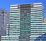
2 Broadway is an office building at the south end of Broadway, near Bowling Green Park, in the Financial District of Manhattan in New York City. The 32-story building, designed by Emery Roth & Sons and constructed from 1958 to 1959, contains offices for the Metropolitan Transportation Authority (MTA). 2 Broadway serves as the headquarters for some of the MTA's subsidiary agencies. The building is on a site bounded by Broadway and Whitehall Street to the west, Beaver Street to the north, and Stone Street to the south. It fills most of the lot, with the building rising in triple setbacks. The facade is covered in blue-green tinted glass, which dates from a 1999 redesign by Skidmore, Owings & Merrill. The site was previously occupied by George B. Post's New York Produce Exchange building, which was completed in 1884. Plans for the skyscraper date to 1953, when William Lescaze devised plans to replace the Produce Exchange Building. Emery Roth & Sons were selected to be the architects when Uris Buildings Corporation took over the project. The original tenants were largely financial firms, while the Produce Exchange owned the land under the building and occupied some lower floors. Olympia and York acquired 2 Broadway in 1976 and the underlying land in 1983. After the building became mostly vacant during the early 1990s, Tamir Sapir purchased 2 Broadway in 1995. The building was renovated after the MTA leased all the space in 1998, although the project encountered high costs and several delays.

South Ferry/Whitehall Street station

The South Ferry/Whitehall Street station is a New York City Subway station complex in the Manhattan neighborhood of Financial District, under Battery Park. The complex is shared by the IRT Broadway–Seventh Avenue Line and the BMT Broadway Line. It is served by the 1 and R trains at all times, the N train during late nights only, and the W train during weekdays only. The complex originally consisted of three separate stations. In 1905, the Interborough Rapid Transit Company (IRT) opened a balloon loop at South Ferry, serving the IRT Broadway–Seventh Avenue and IRT Lexington Avenue Lines. The Brooklyn–Manhattan Transit Corporation (BMT) opened its station at Whitehall Street in 1918. The same year, the IRT opened a second loop for the IRT Lexington Avenue Line on the inside of the existing loop; the two loop stations were not connected to each other nor to the BMT station. Despite their proximity, the stations remained separate for 91 years. In the early 2000s, as part of the recovery effort from the September 11, 2001, attacks, a new South Ferry terminal for the Broadway–Seventh Avenue Line was proposed. That station opened in 2009, replacing the loop station and providing a connection between the Broadway–Seventh Avenue Line's 1 train and the Broadway Line's N, R, and W trains. The new terminal for the Broadway–Seventh Avenue Line was severely damaged during Hurricane Sandy in 2012, and the MTA temporarily re-opened the loop station between 2013 and 2017, adding a temporary connection between the IRT Broadway–Seventh Avenue Line's loop and the BMT Broadway Line's platforms. The newer terminal reopened in June 2017 following extensive renovations and waterproofing work. This station complex is the third on the site to bear the name South Ferry. The first was an elevated station located nearby, which was open from 1877 to 1950 and served the former IRT Ninth, Sixth, Third, and Second Avenue elevated lines. The second was the old South Ferry loop station, located above the existing station complex.

Marketfield Street
Marketfield Street

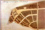
Marketfield Street is a short one-way, one-block-long alleyway in the Financial District of Manhattan, New York City. The street begins as a southern branch of Beaver Street, then veers east and north, ending at Broad Street. Alternative past names include Exchange Street, Field Street, Fieldmarket Street, Oblique Road, and Petticoat Lane.The name Marketfield Street is a translation from the Dutch. The street originally ran to the Dutch livestock market, Marcktveldt, located near where Battery Park is now, which was then outside the walls of the city. The market operated from 1638 to 1647. In 1641, the Governor-General of New Netherland, Willem Kieft, opened the colony's first cattle market there.By 1680, mainly poor people were living on Marketfield Street. In 1688, the city's first French Huguenot church was built there.In September 1776, Marketfield Street was part of the area devastated by the Great Fire of New York, which engulfed the southwestern tip of Manhattan. In 1821, a hurricane hit the East Coast, destroying the street's dock. In 1821, Marketfield Street, which overlooked the Hudson River, had a single name throughout its length, but by the 1830s, the street was renamed "Battery Place" from Bowling Green to the Hudson River. The 1882 construction of the New York City Produce Exchange demolished the block of the street that contained the French church.The American Bank Note Company Building at 70 Broad Street, between Marketfield and Beaver Street, was erected in 1908 as the headquarters of the American Bank Note Company.