place

Jacob Riis Park

Art Deco architecture in Queens, New YorkGateway National Recreation AreaHistoric districts in Queens, New YorkHistoric districts in the United StatesHistoric districts on the National Register of Historic Places in Queens, New York
Parks in Queens, New YorkRobert Moses projectsRockaway, QueensUse mdy dates from May 2018
Jacob Riis Park
Jacob Riis Park

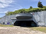
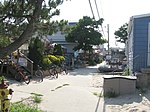
Jacob Riis Park, also called Jacob A. Riis Park and Riis Park, is a seaside park on the southwestern portion of the Rockaway Peninsula in the New York City borough of Queens. It lies at the foot of the Marine Parkway–Gil Hodges Memorial Bridge, east of Fort Tilden, and west of Neponsit and Rockaway Beach. Originally run by the New York City Department of Parks and Recreation, it is now part of the Jamaica Bay Unit of the Gateway National Recreation Area, and is managed by the National Park Service (NPS). It features an extensive sand beach along the Atlantic Ocean coastline and several historic Art Deco structures. In 1912, the city, urged on by social journalist Jacob Riis, acquired the land for a park initially called Seaside Park and later Telawana Park. In 1914, the park was renamed for Riis. During World War I, the site was used as the Rockaway Naval Air Station, one of the first naval air stations in the United States and, in 1919, the launching point for the first transatlantic flight. The signature bathhouse was built in 1932, but much of the park's infrastructure and approaches were built between 1936 and 1937 by New York City Parks Commissioner Robert Moses, who envisioned it as a getaway for New York City residents, like Jones Beach State Park further east on Long Island. The park was built along with the Marine Parkway Bridge and the Belt Parkway in nearby Brooklyn, which provided access to the park. After a period of decline, Jacob Riis Park was transferred in 1974 to the control of the National Park Service. The Jacob Riis Park Historic District was listed on the National Register of Historic Places in 1981.

Excerpt from the Wikipedia article Jacob Riis Park (License: CC BY-SA 3.0, Authors, Images).

Jacob Riis Park
Beach Channel Drive Greenway, New York Queens

Geographical coordinates (GPS) Address External links Nearby Places
placeShow on map

Wikipedia: Jacob Riis ParkContinue reading on Wikipedia

Geographical coordinates (GPS)

Latitude Longitude
N 40.5675 ° E -73.873333333333 °
placeShow on map

Address

Jacob Riis Park Historic District

Beach Channel Drive Greenway
11694 New York, Queens
New York, United States
mapOpen on Google Maps

linkWikiData (Q6119176)
linkOpenStreetMap (9459897)

Jacob Riis Park
Jacob Riis Park
Share experience

Nearby Places

Naval Air Station Rockaway

Naval Air Station Rockaway adjoined Fort Tilden on the western portion of the Rockaway Peninsula in the New York City borough of Queens. It was established on transferred municipal property in 1917 during American involvement in World War I. The station was the departure point for the first transatlantic flight in 1919, executed by the crew of the NC-4. On November 27, 1918, the NC-1 took off from the station with 51 people aboard, establishing a new world record for persons carried in flight.In 1920, U.S. Navy balloon A-5598 departed for the air station. It went off-course and its crew of three were recorded missing for several weeks, lost in the Canadian wilderness. On August 31, 1921, an airship hangar caught fire. It destroyed the D-6 blimp along with two small dirigibles, the C-10 and the H-1 and the kite balloon A-P. The D-6 was built by the Naval Aircraft Factory, Philadelphia, Pennsylvania, to a design somewhat different from the other five D-class airships. It featured an improved control car (the "D-1 Enclosed Cabin Car) which had a watertight bottom for landings on water, and internal fuel tanks. The station was demolished in 1930 to make way for Jacob Riis Park. Operations were moved across the inlet to a hangar in the municipal Floyd Bennett Field, which itself was sold to the federal government in 1941 and made Naval Air Station New York. In turn, NAS New York was decommissioned in 1972 and is now a part of the Gateway National Recreation Area, as are Fort Tilden and Jacob Riis Park.

Floyd Bennett Field
Floyd Bennett Field

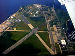
Floyd Bennett Field is an airfield in the Marine Park neighborhood of southeast Brooklyn in New York City, along the shore of Jamaica Bay. The airport originally hosted commercial and general aviation traffic before being used as a naval air station. Bennett Field is currently part of the Gateway National Recreation Area's Jamaica Bay Unit, and is managed by the National Park Service (NPS). While no longer used as an operational commercial, military, or general aviation airfield, a section is still used as a helicopter base by the New York City Police Department (NYPD), and one runway is reserved for hobbyists flying radio-controlled aircraft. Floyd Bennett Field was created by connecting Barren Island and several smaller islands to the rest of Brooklyn by filling the channels between them with sand pumped from the bottom of Jamaica Bay. The airport was named after Floyd Bennett, a noted aviator who piloted the first plane to fly over the North Pole and had visualized an airport at Barren Island before dying in 1928; construction on Bennett Field started the same year. The airport was dedicated on June 26, 1930, and officially opened to commercial flights on May 23, 1931. Despite the exceptional quality of its facilities, Bennett Field never received much commercial traffic, and it was used instead for general aviation. During the interwar period, dozens of aviation records were set by aviators flying to or from Bennett Field.Starting in the 1930s, the United States Coast Guard and United States Navy occupied part of the airport. With the outbreak of World War II, Bennett Field became part of Naval Air Station New York on June 2, 1941. Floyd Bennett Field was a hub for naval activities during World War II. After the war, the airport was used as a Naval Air Reserve station. In 1970, the Navy stopped using Bennett Field, though a reserve center remained until 1983, and the Coast Guard remained through 1998. Several plans for the use of Bennett Field were proposed, and in 1972, it was ultimately decided to integrate the airport into the Gateway National Recreation Area. Floyd Bennett Field reopened as a park in 1974.Many of the earliest surviving original structures are included in a historic district listed on the National Register of Historic Places, being among the largest collections and best representatives of commercial aviation architecture from the period, and due to the significant contributions to general aviation and military aviation made there during the Interwar period. Bennett Field also contains facilities such as a natural area, a campground, and grasslands.