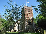
Mileham

Mileham is a village approximately midway between East Dereham and Fakenham in Mid Norfolk with a population of 563 people in 2011. The village sits astride the B1145 Kings Lynn to Mundesley road that dissects Mid Norfolk west to east. It is the old coaching road from Kings Lynn to Norwich and then on to Great Yarmouth. The name Mileham comes from the presence of a mill; the base of the last one can still be seen from the Litcham Road. (There is a possibility that it may be linked to a Saxon water mill.) There is also a "Mill Farm" to the west of the village. Mileham is a linear settlement in 'High Norfolk', and is also a 'Conservation Village', centred on Burwood Hall, The Church, The Castle, Park Farm, Old Hall Farm and Manor Farm. There are ruins of a Norman castle (now a nature reserve) near to the site of the Roman Camp and a church, St John the Baptist, with some rare stained glass windows.
Excerpt from the Wikipedia article Mileham (License: CC BY-SA 3.0, Authors, Images).Mileham
The Street, Breckland District Mileham
Geographical coordinates (GPS) Address Nearby Places Show on map
Geographical coordinates (GPS)
| Latitude | Longitude |
|---|---|
| N 52.73751 ° | E 0.83397 ° |
Address
The Street
The Street
PE32 2RB Breckland District, Mileham
England, United Kingdom
Open on Google Maps


