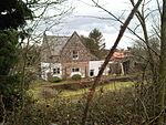
Litcham

Litcham is a village and civil parish in the English county of Norfolk. It is situated some 10 km (6.2 mi) north-east of the town of Swaffham and 40 km (25 mi) west of the city of Norwich. The village is located on the B1145 a route which runs between King's Lynn and Mundesley. The civil parish has an area of 7.89 km2 (3.05 sq mi) and in the 2001 census had a population of 592 in 257 households at the time of the 2001 census, increasing to a population of 618 in 217 households at the 2011 Census. For the purposes of local government, the parish falls within the district of Breckland. Litcham is in the Launditch hundred of the Breckland district of Norfolk, England. It is almost equidistant from three major market towns: East Dereham, Fakenham and Swaffham. The Bull Inn is a 17th-century coaching inn with parts dating back to the 14th century. It is the one surviving of many pubs once serving the village. The village has all the necessary amenities such as a post office, butchers, church, Methodist chapel, bus garage, fish and chip shop and health centre.
Excerpt from the Wikipedia article Litcham (License: CC BY-SA 3.0, Authors, Images).Litcham
Back Street, Breckland District Litcham
Geographical coordinates (GPS) Address Nearby Places Show on map
Geographical coordinates (GPS)
| Latitude | Longitude |
|---|---|
| N 52.72415 ° | E 0.79142 ° |
Address
Back Street
Back Street
PE32 2PA Breckland District, Litcham
England, United Kingdom
Open on Google Maps


