place

Upper Greenwood Lake, New Jersey

Census-designated places in New JerseyCensus-designated places in Passaic County, New JerseyCensus-designated places in Sussex County, New JerseyUse American English from June 2023Use mdy dates from June 2023
Vernon Township, New JerseyWest Milford, New Jersey

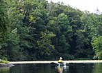
Upper Greenwood Lake is a census-designated place (CDP) in Passaic and Sussex counties, in the U.S. state of New Jersey. It includes residential neighborhoods around the northern and central parts of its namesake lake. It is primarily in West Milford Township in Passaic County but extends to the northwest into Vernon Township in Sussex County. It is bordered to the west by Wawayanda State Park, to the southeast by Abram S. Hewitt State Forest, and to the northeast by the town of Warwick in Orange County, New York. The lake drains to the northeast into Long House Creek, which descends into New York and joins Wawayanda Creek, a west-flowing tributary of Pochuck Creek, which in turn runs north to the Wallkill River, a northeast-flowing tributary of the Hudson. The Upper Greenwood Lake community was first listed as a CDP prior to the 2020 census.

Excerpt from the Wikipedia article Upper Greenwood Lake, New Jersey (License: CC BY-SA 3.0, Authors).

Upper Greenwood Lake, New Jersey
Lake Shore Drive,

Geographical coordinates (GPS) Address Nearby Places
placeShow on map

Wikipedia: Upper Greenwood Lake, New JerseyContinue reading on Wikipedia

Geographical coordinates (GPS)

Latitude Longitude
N 41.183333333333 ° E -74.38 °
placeShow on map

Address

Lake Shore Drive 567
07421
New Jersey, United States
mapOpen on Google Maps

Share experience

Nearby Places

Wawayanda State Park

Wawayanda State Park is a 34,350 acres (139.0 km2) state park in Sussex County and Passaic County in northern New Jersey. The park is in Vernon Township on the Sussex side, and West Milford on the Passaic side. There are 60 miles (97 km) of hiking trails in the park, including a 20 miles (32 km) stretch of the Appalachian Trail. The park is operated and maintained by the New Jersey Division of Parks and Forestry. The hiking trails are maintained and updated by the New York - New Jersey Trail Conference. The park is part of the Northeastern coastal forests ecoregion. It is home to the red-shouldered hawk, the barred owl and the great blue heron, and includes 1,300-foot (396 m) Wawayanda Mountain and glacially-formed, spring-fed Wawayanda Lake with a swimming beach and boat launch and group camping. The 1,325 acres (5.36 km2) Bearfort Mountain Natural Area is a part of the park, with Terrace Pond at 1,380 feet (420 m) near the top. The mountain forest includes swamp hardwood, hemlock and mixed hardwood and chestnut oak forest communities; some rock outcrops have a 360-degree view of the surrounding highlands. 2,167 acres (8.77 km2) Wawayanda Swamp Natural Area is an Atlantic white cedar swamp with a mixed oak-hardwood forest and a lake and Laurel Pond. 399 acres (1.61 km2) Wawayanda Hemlock Ravine Natural Area is a 300 feet (91 m) ravine formed by Doublekill Creek surrounded by a hemlock and mixed hardwood forest. The Appalachian Trail is located on the western edge of the area.

Greenwood Lake
Greenwood Lake

Greenwood Lake is an interstate lake approximately seven miles (11 km) long, straddling the border of New York and New Jersey. It is located in the Town of Warwick and the Village of Greenwood Lake, New York (in Orange County) and West Milford, New Jersey (in Passaic County). It is the source of the Wanaque River. The lake was originally called "Quampium" by the Munsee Native Americans who lived there. It was renamed "Long Pond" by Europeans, who settled the area in the 18th century for farming and ironmaking, and eventually came to be re-christened "Greenwood Lake." It was dammed up c. 1765 by Peter Hasenclever of The American Company to increase the size of the lake for water power used downstream at the Long Pond Ironworks. The original dam was located even with today's Fox Island, with most of the lake extending north of the state line. In 1837, the lake was again dammed, but at the location of the current dam, this time by the Morris Canal & Banking Company to supply water to the Pompton Feeder of the Morris Canal. The enlarged lake now flooded the Succor Brook at the northern end, forming the East Arm, surrounded "Lime Ridge" to create Chapel Island, and flooded the extreme southern end, including parts of Belcher Creek. The enlarged lake began to attract tourists. The Montclair and Greenwood Lake Railway reached the lake at Awosting around 1874, and the "State Line" (later Sterling Forest) depot was established around 1876. (This railway later became the New York and Greenwood Lake Railway, and then the Greenwood Lake Division of the Erie Railway.) During its resort era, several steamboats operated on the lake, including the Greenwood Lake Transportation Company's Arlington, Milford, and their side-wheeler, Montclair, built in 1876, which had two decks and is reported to have been capable of carrying from 200 to 400 passengers. There were also other steamers that were privately run, such as the Pioneer and the Anita, and smaller steam launches, such as the Wilhelmina, the Carrie T., and the Ferncliff, run by specific hotels. These steamboats met the trains and took passengers to the various resorts around the lake in both states. There is a seaplane area on the lake, a few large marinas and lakeside restaurants with docks. Greenwood Lake Airport just south of the lake has a runway long enough to handle small jets. There are numerous marinas and restaurants along Greenwood Lake. In 2011, the film The Magic of Belle Isle starring Morgan Freeman was filmed along the lake.

Sterling Forest, New York

Sterling Forest, New York is a hamlet in the Town of Warwick, Orange County. It is served by an active United States post office of the same name. It is situated on the eastern shore of Greenwood Lake, at the New Jersey state line. Part of the hamlet extends into West Milford Township, Passaic County, New Jersey. The hamlet grew up around the terminal station of the Montclair and Greenwood Lake Railway, later called the New York and Greenwood Lake Railway, and later the Greenwood Lake division of the Erie Railroad. The railroad reached this point around 1875, with the station located at the state line in New Jersey. The depot complex originally contained the Sterling Forest, New Jersey post office. The post office was moved to the New York side of the line in 1926, where it continues to operate. Rail service ceased in 1935. The coming of the railroad was preceded by the construction of a large commercial ice house by the Ringwood Company around 1864. The Sterling Forest ice house was later operated by the Mountain Ice Company of Hoboken, New Jersey. It ceased operation and was eventually torn down in 1945. At one time, the hamlet also boasted two hotels (one in New Jersey), a general store, lumber yard, two bars (in addition to those in the hotels) and a Roman Catholic church (in New Jersey). Today, the only businesses that remain are one bar/restaurant, and a marina (on the site of the depot). In the 1930s and 1940s, Yankee great Babe Ruth often rented a cabin in the hamlet for the summer, and was known to play baseball with the local neighborhood children at a small ballfield located there. It was the site of the first American rocket airplane flight that carried mail from the New York side of the state line to the New Jersey side on February 23, 1936. Often confused with Sterling Forest, New York is the old Sterling Forest Gardens property and the adjacent Sterling Forest State Park, both located several miles away in the Town of Tuxedo, New York. The property is now the site of the New York Renaissance Faire, an annual Renaissance fair. Adding to the confusion, there is another fair called The Sterling Renaissance Festival which is located north of Syracuse, NY.