place

General John Hathorn Stone House

Houses completed in 1773Houses in Orange County, New YorkHouses on the National Register of Historic Places in New York (state)National Register of Historic Places in Orange County, New YorkWarwick, New York
General John Hathorn Stone House

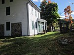
The General John Hathorn Stone House is located on Hathorn Road in the town of Warwick, New York, United States, just off NY 94 a mile south of the village of Warwick. It was built by Hathorn in 1773 but expanded considerably in the mid-19th century.It is on a 14-acre (5.6-ha) lot, the remainder of the original 300 acres (120 ha) Hathorn and his family farmed. In 2001 it and an early-19th-century outbuilding were listed on the National Register of Historic Places.

Excerpt from the Wikipedia article General John Hathorn Stone House (License: CC BY-SA 3.0, Authors, Images).

General John Hathorn Stone House
Hathorn Road,

Geographical coordinates (GPS) Address Nearby Places
placeShow on map

Wikipedia: General John Hathorn Stone HouseContinue reading on Wikipedia

Geographical coordinates (GPS)

Latitude Longitude
N 41.245277777778 ° E -74.370555555556 °
placeShow on map

Address

Hathorn Road 21
10990
New York, United States
mapOpen on Google Maps

General John Hathorn Stone House
Share experience

Nearby Places

Wawayanda State Park

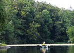
Wawayanda State Park is a 34,350 acres (139.0 km2) state park in Sussex County and Passaic County in northern New Jersey. The park is in Vernon Township on the Sussex side, and West Milford on the Passaic side. There are 60 miles (97 km) of hiking trails in the park, including a 20 miles (32 km) stretch of the Appalachian Trail. The park is operated and maintained by the New Jersey Division of Parks and Forestry. The hiking trails are maintained and updated by the New York - New Jersey Trail Conference. The park is part of the Northeastern coastal forests ecoregion. It is home to the red-shouldered hawk, the barred owl and the great blue heron, and includes 1,300-foot (396 m) Wawayanda Mountain and glacially-formed, spring-fed Wawayanda Lake with a swimming beach and boat launch and group camping. The 1,325 acres (5.36 km2) Bearfort Mountain Natural Area is a part of the park, with Terrace Pond at 1,380 feet (420 m) near the top. The mountain forest includes swamp hardwood, hemlock and mixed hardwood and chestnut oak forest communities; some rock outcrops have a 360-degree view of the surrounding highlands. 2,167 acres (8.77 km2) Wawayanda Swamp Natural Area is an Atlantic white cedar swamp with a mixed oak-hardwood forest and a lake and Laurel Pond. 399 acres (1.61 km2) Wawayanda Hemlock Ravine Natural Area is a 300 feet (91 m) ravine formed by Doublekill Creek surrounded by a hemlock and mixed hardwood forest. The Appalachian Trail is located on the western edge of the area.