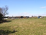
Chalgrove
Civil parishes in OxfordshireSouth Oxfordshire DistrictUse British English from February 2015Villages in Oxfordshire

Chalgrove is a village and civil parish in South Oxfordshire about 10 miles (16 km) southeast of Oxford. The parish includes the hamlet of Rofford and the former parish of Warpsgrove with which it merged in 1932. The 2011 Census recorded the parish population as 2,830. Chalgrove is the site of a small Civil War battle in 1643, the Battle of Chalgrove Field. The Parliamentarian John Hampden was wounded in the battle, and died of his wounds six days later.
Excerpt from the Wikipedia article Chalgrove (License: CC BY-SA 3.0, Authors, Images).Chalgrove
High Street, South Oxfordshire Chalgrove
Geographical coordinates (GPS) Address Nearby Places Show on map
Geographical coordinates (GPS)
| Latitude | Longitude |
|---|---|
| N 51.665 ° | E -1.077 ° |
Address
High Street
High Street
OX44 7SS South Oxfordshire, Chalgrove
England, United Kingdom
Open on Google Maps
