place

River Strat

Rivers of Cornwall
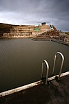
The River Strat in Stratton geograph.org.uk 1801257

The River Strat is a river in the northernmost part of Cornwall in southwest England. The Strat flows for 12.7 miles to the sea at Bude, having risen to the south of Kilkhampton. It flows initially in a generally southwesterly direction through Stratton to a meeting with its major tributary, the River Neet at Helebridge. The river then turns abruptly to the north-northwest, parallel to the coast which it meets at Bude Haven. The Neet rises to the east of Week St Mary and flow north and northwest to its confluence with the Strat. Other of its tributaries rise to the west of Week St Mary. The section downstream from the vicinity of Helebridge is accompanied by the now disused Bude Canal. The rivers are home to trout, lamprey and eels. The Strat is sometimes also referred to as the River Neet. Older forms of the name of Stratton include Straetneat, one of the meanings of which may be the 'valley of the (river known as) Neat'.

Excerpt from the Wikipedia article River Strat (License: CC BY-SA 3.0, Authors, Images).

River Strat
Breakwater Road,

Geographical coordinates (GPS) Address Nearby Places
placeShow on map

Wikipedia: River StratContinue reading on Wikipedia

Geographical coordinates (GPS)

Latitude Longitude
N 50.8297 ° E -4.5523 °
placeShow on map

Address

Ivy Cottage

Breakwater Road
EX23 8LH , Bude–Stratton
England, United Kingdom
mapOpen on Google Maps

The River Strat in Stratton geograph.org.uk 1801257
Share experience

Nearby Places

Compass Point storm tower

The Storm Tower at Compass Point, Bude–Stratton, Cornwall, England, is an octagonal lookout tower, modelled on the Tower of the Winds in Athens, Greece. It is known locally as the Pepperpot.The tower was built in 1835 on the instructions of Sir Thomas Dyke Acland, 10th Baronet, to a design by George Wightwick, as a place from which coastguards could observe ships on the adjacent Atlantic Ocean.Historic England describe it thus: Roughly-dressed stone brought to course with freestone quoins... on plinth with 3 granite steps up to entrance on east side. Entrance has entablature and pediment on freestone pilasters. Each side has slit window with stone sill, those to north-east and north-west blocked. The points of the compass are carved as a frieze in sans-serif below the moulded cornice. Low pyramidal roof with moulded base to cross formerly surmounting tower. Interior has slate floor and brick dressings to slit windows. The current roof is not original. As built, the tower was aligned to magnetic north, but polar drift means this is now seven degrees out.The tower sits on a sandstone and shale cliff that is described as friable and which is subject to erosion, averaging 1 metre (1.1 yd) a year, but with the potential for a 25-metre (27 yd) loss at any time. As a result, the tower had to be moved a short distance from the cliff edge in 1881. Because of the ongoing threat of erosion, there are plans to dismantle the tower and reconstruct it 100 metres (110 yd) further inland, at a cost of around £450,000, over a six-month period starting in late April 2023. Funding has been provided by the National Lottery Heritage Fund (£249,362), public crowdfunding (£58,000), Cornwall Council (£50,000) and Bude-Stratton town council (£40,000). The work is to be undertaken by specialist contractors Sally Strachey Historic Conservation.The tower has been Grade II listed since September 1985, giving it legal protection against unauthorised alteration or demolition.