Flexbury
BudeNorth Cornwall geography stubsVillages in Cornwall

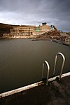
Flexbury is a village about 0.8 miles from Bude, in the civil parish of Bude–Stratton, north Cornwall, England. Described as a hamlet in 1887, residential properties have since been built to the coast at Crooklets beach. In 2018 it had an estimated population of 2290.
Excerpt from the Wikipedia article Flexbury (License: CC BY-SA 3.0, Authors, Images).Flexbury
Poughill Road,
Geographical coordinates (GPS) Address Nearby Places Show on map
Geographical coordinates (GPS)
| Latitude | Longitude |
|---|---|
| N 50.835592 ° | E -4.5412077 ° |
Address
Poughill Road
Poughill Road
EX23 8GQ , Bude–Stratton
England, United Kingdom
Open on Google Maps


