place

Bude Canal

BudeCanals in CornwallCanals opened in 1823Geographic coordinate listsIndustrial archaeological sites in Cornwall
Industrial archaeological sites in DevonLists of coordinatesUse British English from January 2017Works of James Green
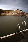
Hobbacott incline
Hobbacott incline

The Bude Canal was a canal built to serve the hilly hinterland in the Devon and Cornwall border territory in the United Kingdom, chiefly to bring lime-bearing sand for agricultural fertiliser. The Bude Canal system was one of the most unusual in Britain.It was remarkable in using inclined planes to haul tub boats on wheels to the upper levels. There were only two conventional locks, in the short broad canal section near the sea at Bude itself. It had a total extent of 35 miles (56 km), and it rose from sea level to an altitude of 433 feet (132 m). The design of the canal influenced the design of the Rolle Canal.

Excerpt from the Wikipedia article Bude Canal (License: CC BY-SA 3.0, Authors, Images).

Geographical coordinates (GPS)

Latitude Longitude
N 50.8275 ° E -4.5479 °
placeShow on map

Address

Olive Tree

Lower Wharf
EX23 8LG , Bude–Stratton
England, United Kingdom
mapOpen on Google Maps

Phone number

call+441288359577

Website
olivetreebude.co.uk

linkVisit website

Hobbacott incline
Hobbacott incline
Share experience

Nearby Places

Compass Point storm tower

The Storm Tower at Compass Point, Bude–Stratton, Cornwall, England, is an octagonal lookout tower, modelled on the Tower of the Winds in Athens, Greece. It is known locally as the Pepperpot.The tower was built in 1835 on the instructions of Sir Thomas Dyke Acland, 10th Baronet, to a design by George Wightwick, as a place from which coastguards could observe ships on the adjacent Atlantic Ocean.Historic England describe it thus: Roughly-dressed stone brought to course with freestone quoins... on plinth with 3 granite steps up to entrance on east side. Entrance has entablature and pediment on freestone pilasters. Each side has slit window with stone sill, those to north-east and north-west blocked. The points of the compass are carved as a frieze in sans-serif below the moulded cornice. Low pyramidal roof with moulded base to cross formerly surmounting tower. Interior has slate floor and brick dressings to slit windows. The current roof is not original. As built, the tower was aligned to magnetic north, but polar drift means this is now seven degrees out.The tower sits on a sandstone and shale cliff that is described as friable and which is subject to erosion, averaging 1 metre (1.1 yd) a year, but with the potential for a 25-metre (27 yd) loss at any time. As a result, the tower had to be moved a short distance from the cliff edge in 1881. Because of the ongoing threat of erosion, there are plans to dismantle the tower and reconstruct it 100 metres (110 yd) further inland, at a cost of around £450,000, over a six-month period starting in late April 2023. Funding has been provided by the National Lottery Heritage Fund (£249,362), public crowdfunding (£58,000), Cornwall Council (£50,000) and Bude-Stratton town council (£40,000). The work is to be undertaken by specialist contractors Sally Strachey Historic Conservation.The tower has been Grade II listed since September 1985, giving it legal protection against unauthorised alteration or demolition.