place

Victoria Point (building)

Apartment buildings in MelbourneModernist architecture in AustraliaResidential buildings completed in 2005Use Australian English from September 2015Victoria (Australia) building and structure stubs
Victoria Point Docklands

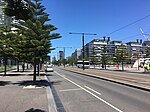
Victoria Point is a 42 level residential tower located at the corner of Bourke Street and Harbour Esplanade in Docklands, a suburb of Melbourne, Australia.The site on which Victoria Point sits was originally controlled by the consortium (including Channel 7 and Baulderstone Hornibrook) which developed the Docklands Stadium. The Melbourne-based developer, RIA Property Group acquired these rights and conceived of and planned the Victoria Point Project, engaging Buchan Architects as lead designers. Construction of the building, by Multiplex on behalf of a joint venture between RIA Property Group and the Brisbane-based Devine Limited, commenced in 2003 and was completed in 2005. Victoria Point incorporates the Melbourne headquarters of Bendigo Bank (undertaken solely by RIA and which was subsequently on-sold to APN) and a separate Quest serviced apartment complex of 115 serviced apartments. RIA sold down its equity in the project to Devine and the project was subsequently taken forward in joint venture. It is 128 metres high and has 42 floors and 447 units.Victoria Point is located at the intersection of Bourke Street and Harbour Esplanade. Street addresses within the development include 100-120 Harbour Esplanade and 744-768 Bourke Street. The building was used as one of the filming locations for the Channel 9 series Underbelly, and appears in episodes 12 and 13 of the series.

Excerpt from the Wikipedia article Victoria Point (building) (License: CC BY-SA 3.0, Authors, Images).

Victoria Point (building)
Harbour Esplanade, Melbourne Docklands

Geographical coordinates (GPS) Address External links Nearby Places
placeShow on map

Wikipedia: Victoria Point (building)Continue reading on Wikipedia

Geographical coordinates (GPS)

Latitude Longitude
N -37.818611111111 ° E 144.94694444444 °
placeShow on map

Address

Victoria Point

Harbour Esplanade 100
3008 Melbourne, Docklands
Victoria, Australia
mapOpen on Google Maps

linkWikiData (Q7926966)
linkOpenStreetMap (296368687)

Victoria Point Docklands
Share experience

Nearby Places

Docklands, Victoria
Docklands, Victoria

Docklands (also known as Melbourne Docklands to differentiate it from London Docklands) is an inner suburb of Melbourne, Victoria, Australia, 2 km (1.2 mi) west of the city's Central Business District (CBD). Its local government area is the City of Melbourne. At the 2016 Census, Docklands had a population of 10,964. Primarily a waterfront area centred on the banks of the Yarra River, it is bounded by Wurundjeri Way and the Charles Grimes Bridge to the east, CityLink to the west and Lorimer Street across the Yarra to the south. The site of modern-day Docklands was originally swamp land that in the 1880s became a bustling dock area as part of the Port of Melbourne, with an extensive network of wharfs, heavy rail infrastructure and light industry. Following the containerisation of shipping traffic, Docklands fell into disuse and by the 1990s was virtually abandoned, making it the focal point of Melbourne's underground rave scene. The construction of Docklands Stadium in the late 1990s attracted developer interest in the area, and urban renewal began in earnest in 2000 with several independent privately developed areas overseen by VicUrban, an agency of the Victorian Government. Docklands subsequently experienced an apartment boom and became a sought-after business address, attracting the national headquarters of, among others, the National Australia Bank, ANZ, Medibank and the Bureau of Meteorology, as well as the regional headquarters for Ericsson and Bendigo Bank.Known for its striking contemporary architecture, the suburb is home to a number of heritage buildings that have been retained for adaptive reuse, and is also the site of landmarks such as the aforementioned Docklands Stadium, Southern Cross Station and the Melbourne Star Observation wheel. Although still incomplete, Docklands' developer-centric planning has split public opinion with some lamenting its lack of green open space, pedestrian activity, transport links and culture.

Charles Grimes Bridge

The Charles Grimes Bridge is a dual-carriageway bridge that carries the Docklands Highway over the Yarra River in the Docklands precinct of Melbourne, Australia. It was named after New South Wales surveyor general Charles Grimes, who was the first European to see the Yarra River. This crossing of the Yarra River was located approximately 700m downstream of the Spencer Street Bridge, supporting dual four-lane structures; the Country Roads Board (later VicRoads) began construction on the bridge and its approach roads in January 1975. It connected Footscray Road on the northern side of the river to Johnson, Lorimer, Montague and Brady Streets on the south side of the river, and was designed to be compatible with a future extension of the West Gate Freeway. The low clearance of the new bridge over the water would prevent shipping access to wharves and dry-dock facilities upstream, resulting in the closure of a number of the river wharves on the upstream side. The bridge was known during the construction as the Johnson Street Bridge, and was opened under that name by the Acting Minister of Transport, the Hon A H Scanlan MP, on 4 August 1978, with the total cost of the bridge and approach works at approximately $30 million; it was renamed the Charles Grimes Bridge in 1983.With the Melbourne Docklands redevelopment of the 1990s, Footscray Road was closed as a through-route and rebuilt as Harbour Esplanade, with Wurundjeri Way was constructed to the east as a replacement route. To connect to this new road, Flinders Street was upgraded, and the north end of the Charles Grimes Bridge was rebuilt on an easterly curve to connect to it. Reconstruction started in June 1999, and was completed by 2001. The bridge superstructure consists of five 33.5m long main spans the river, with five smaller spans between 12m and 24m in length over the existing wharf and riverbank. Each of the bridges carries four traffic lanes in one direction, and a footpath. Computer analysis was required during design due to the complex geometry of the spans.The Jim Stynes Bridge was opened in 2014 to carry pedestrian and cyclist traffic underneath the Charles Grimes Bridge, to connect the Docklands precinct to the Northbank area.

Southern Cross railway station

Southern Cross railway station (until 2005 known as Spencer Street station) is a major railway station in Docklands, Melbourne. It is on Spencer Street, between Collins and La Trobe Streets, at the western edge of the Melbourne central business district. The Docklands Stadium sports arena is 500 metres north-west of the station. The station is owned, operated and maintained by Civic Nexus, a subsidiary of IFM Investors and operating as Southern Cross Station Pty Ltd, under a 30-year lease to 2036 from the Victorian State Government, as part of a public-private partnership. Southern Cross Station Pty Ltd contracts Infranexus Management Pty Ltd (Infranexus) for management services. Infranexus is also wholly owned by IFM.The station is the terminus of the state's regional railway network operated by V/Line, The Overland rail service to Adelaide, and NSW TrainLink XPT services to Sydney. It is also served by suburban rail services operated by Metro Trains, being one of five stations on the City Loop, a mostly underground railway that encircles the Central Business District. It is the second busiest railway station in Melbourne's metropolitan network, with 18.614 million passenger movements recorded in 2017/18. This figure excludes V/Line passengers who use the station. Southern Cross also has a coach terminal underneath the Spencer Outlet shopping complex. Skybus Super Shuttle services to Melbourne Airport and since 2017 to Avalon Airport operate from there, as well as Firefly Express and Greyhound Australia interstate coach services, a coach ran public bus (684) and V/Line coach services to Mildura, Yarram, Mansfield, and other parts of Victoria not served by rail.

Batman's Hill
Batman's Hill

Batman's Hill in Melbourne, Australia was named for the Vandemonian adventurer and grazier John Batman. Now removed, the 18-metre-high hill was located to the south of today's Collins Street and Southern Cross railway station, and is the site of a steel marker the same height as the original hill.The hill, on the traditional country of the Wurundjeri, was first claimed for John Fawkner by his representative Captain John Lancey of the Enterprize, who named it 'Pleasant Hill', and wrote to Fawkner in 1835, Your lordship has been fortunate in the lot I chose for you. A more delightful spot, I think, cannot be. Beautiful grass, a pleasant prospect, a fine fresh-water river, and the vessel alongside the bank discharging at musket-shot distance from a pleasant hill where I intend to put your house. The garden will trend to the south by the east side of the hill ... The west side of the hill is a beautiful prospect. A salt lagoon and piece of marsh will make a beautiful meadow and bounded on the south by the river. The hill is composed of rich, black soil, thinly wooded with honeysuckle and she-oak. Good grass, a quantity of herbage that I cannot name more than three, viz., parsley of good flavour, peppermint, as good as any I ever tasted, and geraniums in abundance. In April 1836 the hill was settled by Batman and his family, who built a house at the base where Batman lived until his death in 1839. His widow and family then moved from the house and the government requisitioned the house for government offices.In 1837, the Hoddle Grid, the first town plan was designed with Batman's Hill as its western boundary. The hill had many other uses, in February 1839 it acted as a grandstand for Melbourne's first horse race, with the site later the site of navigation beacons, and a hospital. Around the same time, Batman's Hill was also the site of the first cricket match played in Victoria by the founders of the Melbourne Cricket Club. The western slope of Batman's Hill was sold to the government in 1847 and a powder magazine was built. At the foot of the slopes were tanning pits and melting works. In 1853 the Victorian Government offered a concession to the Melbourne, Mount Alexander and Murray River Railway Company to build a railway from Melbourne to Echuca, including land to the east of Batman's Hill for the terminus. In 1856 the company failed, and was taken over by the government who formed the Victorian Railways to complete the works, the railway station being erected at Spencer Street in 1858. Growing traffic lead to an expansion of the freight sheds in 1863, with a contract being signed in November that year for the removal of the hill. Demolition was completed by the middle of 1866. Further changes came with the construction of the No 2 Goods Shed, the Railways Headquarters Building in Spencer Street, Flinders Street Viaduct, Flinders Street Extension and the retaining wall just south of the goods yards in the 1880s and 90s.The site now forms the eastern border of the Melbourne Docklands (a precinct of the Docklands development is also named Batman's Hill) and is dominated by Southern Cross station and the Collins Street bridge built in 2002 to replicate the original curve and shape of the hill. The new headquarters of The Age newspaper are located to the southern side of the bridge. A significant portion of Batman's Hill is now being developed by the Walker Group as a commercial office precinct called Collins Square. A 1920s hotel, the Batman's Hill Hotel was named after Batman's Hill.