place

Crowden, Derbyshire

Derbyshire geography stubsHamlets in DerbyshireHigh Peak, DerbyshireTowns and villages of the Peak District
Crowden geograph.org.uk 377592

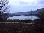
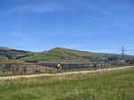
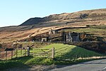
Crowden (also known as Crowden-in-Longdendale) is a hamlet in the High Peak borough of Derbyshire, England. Historically a part of Cheshire, Crowden was incorporated into Derbyshire for administrative and ceremonial purposes in 1974 and is now Derbyshire's most northerly settlement. It lies in the Longdendale valley, 5.8 miles (9.3 km) north-east of Glossop and 5.7 miles (9.2 km) south-west of Holme in West Yorkshire. It lies on the trans-Pennine A628 road connecting Greater Manchester and South Yorkshire. It also lies very close to the Pennine Way long distance footpath, on which it is traditionally the first-night stop after Edale. A youth hostel, previously operated under a joint management agreement by the Youth Hostels Association (England & Wales) and Rotherham Metropolitan Borough Council, was transferred to the sole management of Rotherham Metropolitan Borough Council and closed (except for use by large groups) in 2014. The Torside Reservoir is to the south of Crowden. An army rifle range was situated at Crowden in the 1950s and 1960s.The hamlet was previously served by Crowden railway station on the Woodhead Line between the cities of Manchester and Sheffield, but the station closed on 4 February 1957.

Excerpt from the Wikipedia article Crowden, Derbyshire (License: CC BY-SA 3.0, Authors, Images).

Crowden, Derbyshire
Woodhead Road, High Peak

Geographical coordinates (GPS) Address Website Nearby Places
placeShow on map

Wikipedia: Crowden, DerbyshireContinue reading on Wikipedia

Geographical coordinates (GPS)

Latitude Longitude
N 53.49 ° E -1.894 °
placeShow on map

Address

Crowden Campsite

Woodhead Road
SK13 1HZ High Peak
England, United Kingdom
mapOpen on Google Maps

Website
campingandcaravanningclub.co.uk

linkVisit website

Crowden geograph.org.uk 377592
Share experience

Nearby Places

Rhodeswood Reservoir

Rhodeswood Reservoir is a man-made lake in Longdendale in north Derbyshire, England. It was constructed by John Frederick Bateman between 1849 and June 1855 as part of the Longdendale Chain of reservoirs to supply water from the River Etherow to the urban areas of Greater Manchester. It is third in the chain, and it is from here that the water is extracted to pass through the Mottram Tunnel to Godley for Manchester.The Manchester Corporation Waterworks Act 1847 gave permission for the construction of the Woodhead and Arnfield reservoirs; the Manchester Corporation Waterworks Act 1848 allowed the construction of Torside and Rhodeswood Reservoirs, and an aqueduct to convey the water to the Arnfield reservoir where it would pass through the Mottram Tunnel to Godley. During construction, landslips were a problem. On the night of 6 February 1852, 30 acres (120,000 m2) of land beneath the contractors' village of New Yarmouth moved 6 inches (150 mm) obliquely to the watercourse. Bateman consulted the engineers Robert Stephenson and Isambard Kingdom Brunel. Pipes were sunk to draw off the water from the underlying shale.The purest water in a reservoir lies between 1.5 and 3 metres (4 ft 11 in and 9 ft 10 in) beneath the water's surface, so water was extracted by means of syphons. The water now flows directly to the Arnfield Treatment Works in Tintwistle and to the Mottram Tunnel. A statutory report, prepared under the Reservoir Safety Act 1975 and dated 12 June, stated that all five reservoirs could be overtopped during a Probable Maximum Flood. Woodhead as the fountainhead would have the most extensive improvements, and with these completed there was no danger at Rhodeswood of overtopping; however, there was weakness in the north spillway. To reduce the pressure, the roadway was consolidated to protect the north spillway from erosion, the embankment was raised by 40 millimetres (1.6 in) above the road, the wave wall was heightened by 1.2 m (3 ft 11 in) and the south spillway tunnel was remodelled. The work took place between 1994 and 1995.

Woodhead, Derbyshire

Woodhead is a small and scattered settlement at the head of the Longdendale valley in Derbyshire, England. It lies on the trans-Pennine A628 road connecting Greater Manchester and South Yorkshire, 6 miles (10 km) north of Glossop, 19 miles (31 km) east of Manchester and 18 miles (29 km) west of Barnsley. It is close to the River Etherow and the Trans Pennine Trail. Although part of Derbyshire since 1974, like nearby Tintwistle and Crowden, the hamlet was in the historic county of Cheshire.Woodhead is the location of the western portals of the Woodhead Tunnels, which are three former railway tunnels on the electrified Woodhead Line between Manchester and Sheffield. There was formerly a railway station and signal box at Woodhead. The Woodhead railway line closed in 1981; the trackbed between Woodhead and Hadfield now forms the Longdendale Trail. The platforms are still intact, although the track has been removed. Among the remains in the graveyard of St James Church, a small 18th-century chapel, are the unmarked graves of navvies who died during the construction of the tunnels. Adjoining the church is Bleak House, a Grade-II-listed 19th-century dwelling. Two miles to the east, the Lady Cross marks the highest point of the former packhorse road from Longdendale to Rotherham. Only its base and the bottom of the shaft survive. The hamlet gives its name to Woodhead Reservoir, the highest in the Longdendale Chain of reservoirs. On 6 July 2014, Stage 2 of the 2014 Tour de France, from York to Sheffield, passed through the hamlet.