place

Featherbed Moss

Derbyshire geography stubsMoorlands of EnglandMountains and hills of DerbyshireMountains and hills of the Peak District
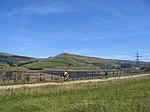
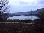
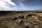
Featherbed Moss geograph.org.uk 245922

Featherbed Moss is a flat-topped hill, 541 metres (1,775 ft) high, in the Peak District in the county of Derbyshire in England. It is sometimes mistakenly thought to be a joint county top.

Excerpt from the Wikipedia article Featherbed Moss (License: CC BY-SA 3.0, Authors, Images).

Featherbed Moss
High Peak

Geographical coordinates (GPS) Address Nearby Places
placeShow on map

Wikipedia: Featherbed MossContinue reading on Wikipedia

Geographical coordinates (GPS)

Latitude Longitude
N 53.507 ° E -1.9314 °
placeShow on map

Address

Tintwistle


High Peak
England, United Kingdom
mapOpen on Google Maps

Featherbed Moss geograph.org.uk 245922
Share experience

Nearby Places

Rhodeswood Reservoir

Rhodeswood Reservoir is a man-made lake in Longdendale in north Derbyshire, England. It was constructed by John Frederick Bateman between 1849 and June 1855 as part of the Longdendale Chain of reservoirs to supply water from the River Etherow to the urban areas of Greater Manchester. It is third in the chain, and it is from here that the water is extracted to pass through the Mottram Tunnel to Godley for Manchester.The Manchester Corporation Waterworks Act 1847 gave permission for the construction of the Woodhead and Arnfield reservoirs; the Manchester Corporation Waterworks Act 1848 allowed the construction of Torside and Rhodeswood Reservoirs, and an aqueduct to convey the water to the Arnfield reservoir where it would pass through the Mottram Tunnel to Godley. During construction, landslips were a problem. On the night of 6 February 1852, 30 acres (120,000 m2) of land beneath the contractors' village of New Yarmouth moved 6 inches (150 mm) obliquely to the watercourse. Bateman consulted the engineers Robert Stephenson and Isambard Kingdom Brunel. Pipes were sunk to draw off the water from the underlying shale.The purest water in a reservoir lies between 1.5 and 3 metres (4 ft 11 in and 9 ft 10 in) beneath the water's surface, so water was extracted by means of syphons. The water now flows directly to the Arnfield Treatment Works in Tintwistle and to the Mottram Tunnel. A statutory report, prepared under the Reservoir Safety Act 1975 and dated 12 June, stated that all five reservoirs could be overtopped during a Probable Maximum Flood. Woodhead as the fountainhead would have the most extensive improvements, and with these completed there was no danger at Rhodeswood of overtopping; however, there was weakness in the north spillway. To reduce the pressure, the roadway was consolidated to protect the north spillway from erosion, the embankment was raised by 40 millimetres (1.6 in) above the road, the wave wall was heightened by 1.2 m (3 ft 11 in) and the south spillway tunnel was remodelled. The work took place between 1994 and 1995.

Valehouse Reservoir
Valehouse Reservoir

Valehouse (or Vale House) Reservoir is a man-made lake in Longdendale in north Derbyshire, England. It was built between 1865 and 1869 as part of the Longdendale Chain of reservoirs, which was built to supply water from the River Etherow to the urban areas of Greater Manchester, while maintaining a constant flow into the river. The upper reservoirs supply the drinking water, while Vale House and Bottoms are compensation reservoirs which guarantee the flow of water to water-powered mills downstream. Valehouse, with a crest elevation of 503 metres (1,650 ft), is too low to supply water under gravity to the Mottram Tunnel, so could not be used as an impounding reservoir. Today 45 megalitres of compensation water are released each day into the River Etherow. Vale House Mill was purchased by Manchester Corporation in 1864, but a few villagers remained in the village of Vale House until 1868. In 1869 the hamlet was flooded out. The village was substantial, having an estimated population of 600 houses and 100 cottages. There was a gasworks and a school house for 24-30 scholars. Vale House Mill was the first spinning and weaving mill in Longdendale; it was built in 1775 by Samuel Oldknow. In 1864, it was owned by William Hobbs and Co. It had two carding rooms, nine spinning rooms, three weaving rooms and two Blowing Rooms. It had 15,416 spindles and 326 power looms. Vale House residents worshipped at the Ebenezer Methodist Chapel in Tintwistle (built in 1830), which was above the reservoir.The chimney at Vale House Mill survived the construction of the reservoir and became known as the "Whispering Chimney" as it produced ghostly noises during strong winds. It was demolished in 1887 at the request of the Manchester to Sheffield Railway Company, who feared for the stability of their trains when all the passengers crowded over to one side of a carriage to see the chimney protruding from the waters of the reservoir. The puddle trench was dug to a depth of 35 feet (11 m) to a layer of lower millstone grit, which rested on limestone shales, and a good watertight seal was easily achieved. It was stated in a statutory report, under the Reservoir Safety Act 1975, dated 12 June 1984, that all five reservoirs could be over-topped during a Probable Maximum Flood, so major works were undertaken. The retention level was raised by 3.81 m (12.5 ft), the embankment crest by 1.8 m (5 ft 11 in), and the wave wall was rebuilt. An 80-metre (260 ft) wide auxiliary spillway was constructed, two new 900-millimetre (35 in) butterfly valves installed and existing valves descaled and motorised. The 11 kV overhead powerline was routed in a new embankment crest duct.

Greenfield Valley
Greenfield Valley

Greenfield Valley is a river valley through Saddleworth Moor in England's Peak District National Park. Historically this area of the South Pennines was part of Yorkshire but since 1974 it has been within the eastern edge of the county of Greater Manchester.The valley and the surrounding Saddleworth Moor are designated as 'Open Access' land for the public, following the Countryside and Rights of Way Act 2000. Much of Saddleworth Moor is a 9,000 year-old peat landscape of blanket bog. The upper Greenfield Valley is part of the Dark Peak SSSI (Site of Special Scientific Interest). The millstone grit moorland is typically covered with grasses, mosses, heather and bilberry and is habitat for mountain hares and moorland birds such as red grouse, lapwing, skylark, curlew, golden plover and meadow pipit. The RSPB operates Dove Stone Nature Reserve in the valley, which includes old quarry cliffs that are home to peregrine falcons.The Trinnacle is a dramatic large stack of three gritstone pillars at Raven Stones Brow. Since glaciers and ice sheets carved the cliff edge during the last Ice Age, weathering and frost-shattering of the rocks over thousands of years have formed the three-pronged Trinnacle outcrop. There are nearly 200 graded rock climbing routes on Ravenstones Crag.The valley's main stream Greenfield Brook is fed by Holme Clough and Birchen Clough. Greenfield Brook flows into Greenfield Reservoir and then on into Yeoman Hey Reservoir and Dovestone Reservoir. It then flows into Chew Brook which is a tributary of the River Tame, which feeds the River Mersey.The Ashton under Lyne, Stalybridge and Dukinfield Waterworks Joint Committee's reservoir scheme began in the Greenfield Valley in 1870. Yeoman Hey Reservoir was completed in 1880 (capacity of 780 million litres and 20m deep). Greenfield Reservoir was built from 1897 to 1902. It is the smallest of the reservoirs (capacity of 464 million litres and 20m deep). Dovestone Reservoir is the largest of the three reservoirs in the valley. It has a capacity of 4887 million litres and is up to 31m deep. The dam is 38m high and 550m long. It was built in 1967 and the Dovestone Sailing Club was established the same year. The reservoirs are operated by United Utilities and supply water to the surrounding area including Oldham. Spruce and pine plantations are found in the lower valley and broad-leaved trees have been introduced to provide a more diverse habitat. Industrialist John Platt built Ashway Gap House in 1850 on the south side of the valley. It was used as a shooting lodge until his brother James (MP for Oldham) was killed in a grouse shooting accident on the moors in 1857. Ashway Cross was erected on the moorland as a memorial to James. The vacant mansion and its estate were bought in 1897 by the waterworks board, which allowed it to be used as a Red Cross hospital for wounded soldiers during World War I. In World War II the house was used to billet Italian prisoners of war. After the house fell into decline it was demolished in 1981.There are two World War II pillboxes (gun emplacements) on the A635 road opposite Yeoman Hey Reservoir. The pillboxes were built into a rock outcrop in c.1940 as part of defences against a possible invasion. The pair are connected by an underground passage. They are protected Grade II listed buildings.Downstream from the reservoirs is Greenfield village in the Chew Valley.