place

Mossy Lea Reservoir

Derbyshire geography stubsDrinking water reservoirs in EnglandReservoirs in DerbyshireReservoirs of the Peak DistrictWorks by John Frederick Bateman
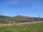
Mossy Lea Farm from Shire Hill geograph.org.uk 990334

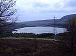
Mossy Lea Reservoir is a disused reservoir near Glossop, north Derbyshire. In 1837, 50 local millowners and gentlemen, known as the "Glossop Commissioners", obtained an Act of Parliament to construct the Glossop Reservoirs. Hurst Reservoir was on the Hurst Brook and Mossy Lea Reservoir was to take water from the Shelf Brook. Only the Hurst Reservoir was constructed before the money ran out. Mossy Lea Reservoir was constructed privately in 1840 by the Duke of Norfolk. It was taken over in 1929 by the Glossop Corporation Waterworks. This became part of the Manchester Corporation Waterworks in 1959. Swineshaw Reservoir, Hurst Reservoir and Mossy Lea Reservoir are no longer in service.

Excerpt from the Wikipedia article Mossy Lea Reservoir (License: CC BY-SA 3.0, Authors, Images).

Mossy Lea Reservoir
High Peak

Geographical coordinates (GPS) Address Nearby Places
placeShow on map

Wikipedia: Mossy Lea ReservoirContinue reading on Wikipedia

Geographical coordinates (GPS)

Latitude Longitude
N 53.4483 ° E -1.9142 °
placeShow on map

Address


SK13 7PQ High Peak
England, United Kingdom
mapOpen on Google Maps

Mossy Lea Farm from Shire Hill geograph.org.uk 990334
Share experience

Nearby Places

Glossop
Glossop

Glossop is a market town in the borough of High Peak, in the county of Derbyshire, England. It is located 15 miles (24 km) east of Manchester, 24 miles (39 km) north-west of Sheffield and 32 miles (51 km) north of the county town, Matlock. Glossop lies near Derbyshire's borders with Cheshire, Greater Manchester, South Yorkshire and West Yorkshire. It is between 150 and 300 metres (492 and 984 ft) above sea level and is bounded by the Peak District National Park to the south, east and north. In 2021 it had a population of 33,340. Historically, the name Glossop refers to the small hamlet that gave its name to an ancient parish recorded in the Domesday Book of 1086 and then the manor given by William I of England to William Peverel. A municipal borough was created in 1866, which encompassed less than half of the manor's territory. The area now known as Glossop approximates to the villages that used to be called Glossopdale, on the lands of the Duke of Norfolk. Originally a centre of wool processing, Glossop rapidly expanded in the late 18th century when it specialised in the production and printing of calico, a coarse cotton. It became a mill town with many chapels and churches; its fortunes were tied to the cotton industry. Architecturally, the area is dominated by buildings constructed with the local sandstone; a number of these, including Glossop Gasworks, are grade II listed. Two significant former cotton mills and the Dinting railway viaduct remain.

Rhodeswood Reservoir

Rhodeswood Reservoir is a man-made lake in Longdendale in north Derbyshire, England. It was constructed by John Frederick Bateman between 1849 and June 1855 as part of the Longdendale Chain of reservoirs to supply water from the River Etherow to the urban areas of Greater Manchester. It is third in the chain, and it is from here that the water is extracted to pass through the Mottram Tunnel to Godley for Manchester.The Manchester Corporation Waterworks Act 1847 gave permission for the construction of the Woodhead and Arnfield reservoirs; the Manchester Corporation Waterworks Act 1848 allowed the construction of Torside and Rhodeswood Reservoirs, and an aqueduct to convey the water to the Arnfield reservoir where it would pass through the Mottram Tunnel to Godley. During construction, landslips were a problem. On the night of 6 February 1852, 30 acres (120,000 m2) of land beneath the contractors' village of New Yarmouth moved 6 inches (150 mm) obliquely to the watercourse. Bateman consulted the engineers Robert Stephenson and Isambard Kingdom Brunel. Pipes were sunk to draw off the water from the underlying shale.The purest water in a reservoir lies between 1.5 and 3 metres (4 ft 11 in and 9 ft 10 in) beneath the water's surface, so water was extracted by means of syphons. The water now flows directly to the Arnfield Treatment Works in Tintwistle and to the Mottram Tunnel. A statutory report, prepared under the Reservoir Safety Act 1975 and dated 12 June, stated that all five reservoirs could be overtopped during a Probable Maximum Flood. Woodhead as the fountainhead would have the most extensive improvements, and with these completed there was no danger at Rhodeswood of overtopping; however, there was weakness in the north spillway. To reduce the pressure, the roadway was consolidated to protect the north spillway from erosion, the embankment was raised by 40 millimetres (1.6 in) above the road, the wave wall was heightened by 1.2 m (3 ft 11 in) and the south spillway tunnel was remodelled. The work took place between 1994 and 1995.