Bleaklow

Bleaklow is a high, largely peat-covered, gritstone moorland in the Derbyshire High Peak near the town of Glossop. It is north of Kinder Scout, across the Snake Pass (A57), and south of the A628 Woodhead Pass. Much of it is nearly 2,000 feet (610 m) above sea level and the shallow bowl of Swains Greave on its eastern side is the source of the River Derwent. Bleaklow Head (633 m), marked by a huge cairn of stones, the high point at the western side of the moor, is a Hewitt and is crossed by the Pennine Way. It is one of three summits on this plateau above 2,000 feet, the others being Bleaklow Stones, some 1.9 miles (3.1 km) to the east along an indefinite ridge, and Higher Shelf Stones, 0.9 miles (1.4 km) south of Bleaklow Head. At 633 metres (2,077 feet), Bleaklow is the second-highest point in Derbyshire and the area includes the most easterly point in the British Isles over 2,000 feet, near Bleaklow Stones.
Excerpt from the Wikipedia article Bleaklow (License: CC BY-SA 3.0, Authors, Images).Bleaklow
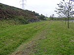
Torside Clough, High Peak
Geographical coordinates (GPS) Address Nearby Places Show on map
Geographical coordinates (GPS)
| Latitude | Longitude |
|---|---|
| N 53.46 ° | E -1.8626 ° |
Address
Wain Stones
Torside Clough
SK13 1JF High Peak
England, United Kingdom
Open on Google Maps


