Scampton
Civil parishes in LincolnshireUse British English from January 2014Villages in LincolnshireWest Lindsey District

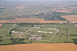
Scampton is a village and civil parish in the West Lindsey district of Lincolnshire, England. The population of the civil parish including Brampton and Broadholme at the 2011 census was 1,358. It is situated 8 km (5 mi) north of Lincoln, 16 km (10 mi) south-east of Gainsborough, and immediately west of the A15. In the civil parish, between the village and the A15, is RAF Scampton, to which the parish lends its name. The airfield first opened in 1916 as Home Defence Flight Station Brattleby, becoming Scampton the following year, and then closing in 1919; it re-opened in 1936 as RAF Scampton.
Excerpt from the Wikipedia article Scampton (License: CC BY-SA 3.0, Authors, Images).Scampton
High Street, West Lindsey
Geographical coordinates (GPS) Address Nearby Places Show on map
Geographical coordinates (GPS)
| Latitude | Longitude |
|---|---|
| N 53.30221 ° | E -0.57668 ° |
Address
High Street
High Street
LN1 2SS West Lindsey
England, United Kingdom
Open on Google Maps


