Patonga, New South Wales
Accuracy disputes from March 2022Suburbs of the Central Coast (New South Wales)Use Australian English from August 2019

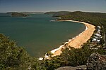
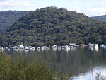
Patonga is a suburb of the Central Coast region of New South Wales, Australia, located on the north bank of the Hawkesbury River, southwest of Woy Woy. It is part of the Central Coast Council local government area.
Excerpt from the Wikipedia article Patonga, New South Wales (License: CC BY-SA 3.0, Authors, Images).Patonga, New South Wales
Patonga Street, Central Coast Council
Geographical coordinates (GPS) Address Nearby Places Show on map
Geographical coordinates (GPS)
| Latitude | Longitude |
|---|---|
| N -33.549 ° | E 151.268 ° |
Address
Patonga Street
Patonga Street
2256 Central Coast Council, Patonga
New South Wales, Australia
Open on Google Maps


